
IMAGES TAKEN NEAR TO
Sutherland Road, STOKE-ON-TRENT, ST9 9QD
Introduction
This page details the photographs taken nearby to Sutherland Road, ST9 9QD by members of the Geograph project.
The Geograph project started in 2005 with the aim of publishing, organising and preserving representative images for every square kilometre of Great Britain, Ireland and the Isle of Man.

There are currently over 7.5m images from over14,400 individuals and you can help contribute to the project by visiting https://www.geograph.org.uk
Image Map
Images are licensed for reuse under creativecommons.org/licenses/by-sa/2.0
Notes
- Clicking on the map will re-center to the selected point.
- The higher the marker number, the further away the image location is from the centre of the postcode.
Image Listing (10 Images Found)
Images are licensed for reuse under creativecommons.org/licenses/by-sa/2.0
Image
Details
Distance
1
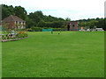
The Rez
This former Severn-Trent reservoir has been converted into an underground diving centre. Divers enter at the far end (where the diver in a day-glo dive suit is) and emerge from the trap door in the left foreground.
Image: © Neil Lewin
Taken: 25 Aug 2006
0.09 miles
2
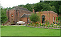
Wallgrange 'Walk-in' Cafe
Converted from the right hand pumphouse at The Rez underground diving centre. Plans are to convert the left pumphouse into a conference centre/meeting room. Both were originally around 3 storeys high.
Image: © Neil Lewin
Taken: 25 Aug 2006
0.09 miles
3
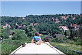
Navigating the Caldon Canal, Leek branch, 1978
A view towards Horse Bridge. The canal curves left then right, to pass behind the house low down on the right. Behind this house the canal is bridged by Sutherland Road.
Image: © Robin Webster
Taken: 28 May 1978
0.16 miles
4
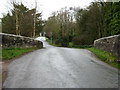
Up Sutherland Road
Looking over the bridge crossing the Leek Branch of the Caldon Canal. There is an upside down bench mark on the left side of the bridge.
Image: © Jonathan Kington
Taken: 30 Mar 2011
0.21 miles
5
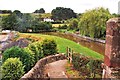
Sutherland Road, Longsdon (standing on the bridge)
A beautiful village flanked by Leek and Cheddleton.
Image: © Stu JP
Taken: 24 Aug 2015
0.22 miles
6
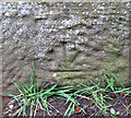
Upside down cut mark
This bench appears upside down on the canal bridge in Image, the bridge has probably been rebuilt in the past with stone put back the wrong way. For more information see http://www.bench-marks.org.uk/bm37437 .
Image: © Jonathan Kington
Taken: 30 Mar 2011
0.22 miles
7
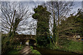
Horse Bridge (No.6) Caldon Canal Leek Branch
The Leek Branch, opened in 1800/01, meets the main line at Hazelhurst Junction
https://en.wikipedia.org/wiki/Caldon_Canal
https://canalrivertrust.org.uk/enjoy-the-waterways/canal-and-river-network/caldon-canal
Image: © Brian Deegan
Taken: 21 Mar 2020
0.22 miles
8
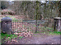
Original entrance to the waterworks
This would have been the original gate to the Longsdon waterworks, Staffordshire Potteries Water Board was one of many independent companies taken over by the Severn Trent Water Authority in 1970's. Just out of sight to the left is the Leek Branch of the Caldon Canal.
Image: © Jonathan Kington
Taken: 30 Mar 2011
0.23 miles
9
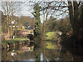
Horse Bridge on the Leek Arm of the Caldon Canal
Image: © Jerry Evans
Taken: 6 Apr 2007
0.23 miles
10
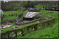
Overflow weir beside the Leek branch of the Caldon Canal
Image: © David Martin
Taken: 12 Apr 2014
0.24 miles