
IMAGES TAKEN NEAR TO
Ash Bank Road, STOKE-ON-TRENT, ST9 0DT
Introduction
This page details the photographs taken nearby to Ash Bank Road, ST9 0DT by members of the Geograph project.
The Geograph project started in 2005 with the aim of publishing, organising and preserving representative images for every square kilometre of Great Britain, Ireland and the Isle of Man.

There are currently over 7.5m images from over14,400 individuals and you can help contribute to the project by visiting https://www.geograph.org.uk
Image Map
Images are licensed for reuse under creativecommons.org/licenses/by-sa/2.0
Notes
- Clicking on the map will re-center to the selected point.
- The higher the marker number, the further away the image location is from the centre of the postcode.
Image Listing (13 Images Found)
Images are licensed for reuse under creativecommons.org/licenses/by-sa/2.0
Image
Details
Distance
1
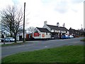
The Red Cow, Werrington
The pub is on Ash Bank Road. For a closer view of the sign Image
Image: © Maigheach-gheal
Taken: 4 Apr 2010
0.06 miles
2
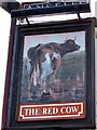
Sign for the Red Cow
The sign shows a pretty happy looking cow, but the sign could do with a bit of a paint job.
Image: © Maigheach-gheal
Taken: 4 Apr 2010
0.08 miles
3
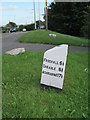
Milepost at Werrington
On the A52, looking east.
Image: © David Weston
Taken: 22 Sep 2013
0.08 miles
4
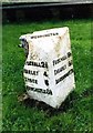
Old Milepost by the A52, Ash Bank Road, Werrington
Cast iron post by the A52, in parish of Werrington (Staffordshire Moorlands District), near Windmill PH in Werrington village, on grass, on South side of road. Lathe iron casting, erected by the County Council in the 19th/20th century.
Inscription reads:-
: (B)UCKNALL 2¾ / HANLEY 4 / STOKE 5 / NEWCASTLE 6½ : : WERRINGTON : : FROGHALL 5½ / CHEADLE 5¾ / ASHBOURNE 17¼ :
Maker:-
: Chas. Lathe, Tipton. :
Grade II listed.
List Entry Number: 1374659 https://historicengland.org.uk/listing/the-list/list-entry/1374659
Milestone Society National ID: ST_ABNC17
Image: © J Higgins
Taken: 1 Jan 2000
0.08 miles
5
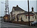
The Windmill Public House
Situated on Ash Bank Road. Just to the left of the pub is an old windmill and in the grounds is a transmission mast.
Image: © Steven Birks
Taken: 17 Feb 2007
0.12 miles
6
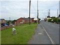
The Werrington milepost in its setting
It sits (rather drunkenly) on the south verge of the A52 in Werrington. The stone has lost a chunk from its top left corner Image
Image: © Richard Law
Taken: 5 Jul 2011
0.14 miles
7
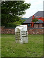
The Werrington milestone - detail
Rather a forlorn looking object, this stone has been damaged and is rather neglected.
Image: © Richard Law
Taken: 5 Jul 2011
0.14 miles
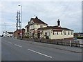
9
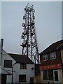
Transmission Tower, Werrington
Situated on the highest point in Werrington sits this transmission tower. It is in the grounds of an old windmill:-
http://www.geograph.org.uk/photo/341006
Image: © Steven Birks
Taken: 17 Feb 2007
0.17 miles
10
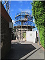
Windmill at Werrington
The windmill is next to a transmission tower, part of which is on the left here. They share the same secured grounds. (The camera is looking between the gaps of a metal gate.)
Image: © David Weston
Taken: 22 Sep 2013
0.17 miles