
IMAGES TAKEN NEAR TO
Oaklands Close, STOKE-ON-TRENT, ST9 0AL
Introduction
This page details the photographs taken nearby to Oaklands Close, ST9 0AL by members of the Geograph project.
The Geograph project started in 2005 with the aim of publishing, organising and preserving representative images for every square kilometre of Great Britain, Ireland and the Isle of Man.

There are currently over 7.5m images from over14,400 individuals and you can help contribute to the project by visiting https://www.geograph.org.uk
Image Map
Images are licensed for reuse under creativecommons.org/licenses/by-sa/2.0
Notes
- Clicking on the map will re-center to the selected point.
- The higher the marker number, the further away the image location is from the centre of the postcode.
Image Listing (15 Images Found)
Images are licensed for reuse under creativecommons.org/licenses/by-sa/2.0
Image
Details
Distance
3
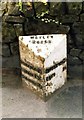
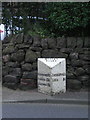
Old Milepost by the A520, Cellarhead Road, Wetley Rocks
Cast iron post by the A520, in parish of Cheddleton (Staffordshire Moorlands District), Cellarhead Road, Wetley Rocks, in tarmac in front of low stone wall, on East side of road. Lathe iron casting, erected by the County Council in the 19th/20th century.
Inscription reads:-
: HILDERSTONE 10 / SANDON 13½ / STAFFORD 18 : : WETLEY / ROCKS : : CHEDDLETON 2½ / LEEK 5½ :
Maker:-
: Chas. Lathe, Tipton. :
Grade II listed.
List Entry Number: 1038099 https://historicengland.org.uk/listing/the-list/list-entry/1038099
Milestone Society National ID: ST_STLK18
Image: © J Higgins
Taken: 1 Jan 2000
0.09 miles
4
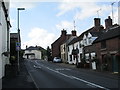
Main Road, Wetley Rocks
Looking south towards the junction with Plough Bank on the left.
Image: © David Weston
Taken: 15 Aug 2014
0.13 miles
5
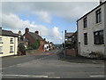
Main Road, Wetley Rocks
Looking north, from the junction of Plough Bank (in the foreground) with Main Road.
Image: © David Weston
Taken: 15 Aug 2014
0.16 miles
6
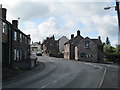
Main Road, Wetley Rocks
Looking south; Mill Lane is on the right.
Image: © David Weston
Taken: 15 Aug 2014
0.17 miles
7

Old Milestone by the A522, Wetley Rocks
Metal plate attached to stone post by the A522, in parish of Cheddleton (STAFFORDSHIRE MOORLANDS District), Wetley Rocks, in hedge, on North side of road. Leek iron plate, erected by the Cheadle (5 Districts) turnpike trust in the 19th century.
Inscription reads:-
LEEK
5
CHEADLE
5
Milestone Society National ID: ST_LKCD05.
Image: © Debbie Williams
Taken: 29 Jun 2025
0.17 miles
8

K6 Telephone Box
A 1936 style telephone kiosk on Mill Lane opposite St. John's church.
Image: © Stu JP
Taken: 18 Mar 2015
0.18 miles
10
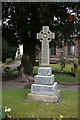
War memorial at Wetley Rocks
In the grounds of St John the Baptist Church.
Image: © Ian S
Taken: 29 Mar 2016
0.22 miles