
IMAGES TAKEN NEAR TO
Outclough Road, STOKE-ON-TRENT, ST8 7QH
Introduction
This page details the photographs taken nearby to Outclough Road, ST8 7QH by members of the Geograph project.
The Geograph project started in 2005 with the aim of publishing, organising and preserving representative images for every square kilometre of Great Britain, Ireland and the Isle of Man.

There are currently over 7.5m images from over14,400 individuals and you can help contribute to the project by visiting https://www.geograph.org.uk
Image Map
Images are licensed for reuse under creativecommons.org/licenses/by-sa/2.0
Notes
- Clicking on the map will re-center to the selected point.
- The higher the marker number, the further away the image location is from the centre of the postcode.
Image Listing (21 Images Found)
Images are licensed for reuse under creativecommons.org/licenses/by-sa/2.0
Image
Details
Distance
1

Cottages, Brindley Ford
Looking over the junction from Fisher Street (on the right) and Bridge Street. The first cottage is currently operating as a hair and beauty salon.
Image: © Richard Dorrell
Taken: 8 Mar 2016
0.03 miles
2
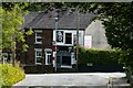
Colour Code
Colour Code, a beauty salon on Bridge Street in Brindley Ford.
Image: © Peter McDermott
Taken: 13 Jul 2023
0.03 miles
3

Fisher Street, Brindley Ford
With the Gardeners Rest pub on the right, and a property for sale on the left.
Image: © Richard Dorrell
Taken: 8 Mar 2016
0.03 miles
4
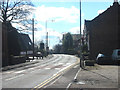
Brindley Ford
The village of Brindley Ford on the A527 as it enters Stoke on Trent from Congleton.
Image: © Phil Eptlett
Taken: 10 Apr 2006
0.06 miles
5
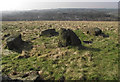
Towards Brindley Ford
Looking down across Brindley Meadow to the rooftops of the houses in Brindley Ford.
The 11.8 hectare Brindley Meadow started life in the 19th century as a sandstone quarry known as Knypersley Quarry. In later years it became a dumping ground for slag from a nearby foundry and for shale from local mining activities, this was to continue until the site was abandoned and left derelict in the 1960’s. In the mid-1990’s a development company, Banks Group ( http://www.banksgroup.co.uk/ ), became involved and applied for, and secured, planning permission to reclaim the quarry. This involved the extraction of coal from underneath the quarry between 1997 and 1999 and the tipping of 250,000 tonnes of inert material into the quarry between 2000 and 2002, with the final reclamation finished in the same year. Approximately 50% of the site is planted with trees to create woodland, the rest with wildflowers and shrubs.
Image: © Jonathan Kington
Taken: 3 Mar 2011
0.09 miles
6
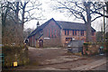
St Chad's, Fisher Street
The Mission Church of St Chad opened 1890. The building is no longer a church, but is now the premises of Elementation Limited, founded in 1983, and producing industrial electric heating elements.
Image: © Richard Dorrell
Taken: 8 Mar 2016
0.09 miles
7
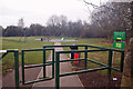
Brindley Ford Recreation Ground
This is the entrance from Fisher Street. The recreation ground, which was equipped with play equipment in 2012, is a Queen Elizabeth II Field In Trust, which safeguards the land as being 'a recreational site for everyone for ever'.
Image: © Richard Dorrell
Taken: 8 Mar 2016
0.10 miles
8
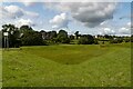
Brindley Ford
Brindley Ford Flood Alleviation Scheme.
Image: © Peter McDermott
Taken: 13 Jul 2023
0.16 miles
9
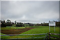
Brindley Ford Flood Alleviation Scheme
Image: © Brian Deegan
Taken: 24 Dec 2022
0.16 miles
10
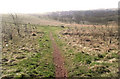
Across the meadow
Looking from the north-eastern entrance to Brindley Meadow to Brindley Ford in the bottom of the valley.
The 11.8 hectare Brindley Meadow started life in the 19th century as a sandstone quarry known as Knypersley Quarry. In later years it became a dumping ground for slag from a nearby foundry and for shale from local mining activities, this was to continue until the site was abandoned and left derelict in the 1960’s. In the mid-1990’s a development company, Banks Group ( http://www.banksgroup.co.uk/ ), became involved and applied for, and secured, planning permission to reclaim the quarry. This involved the extraction of coal from underneath the quarry between 1997 and 1999 and the tipping of 250,000 tonnes of inert material into the quarry between 2000 and 2002, with the final reclamation finished in the same year. Approximately 50% of the site is planted with trees to create woodland, the rest with wildflowers and shrubs.
Image: © Jonathan Kington
Taken: 3 Mar 2011
0.16 miles