
IMAGES TAKEN NEAR TO
Broomfields, STOKE-ON-TRENT, ST8 7JH
Introduction
This page details the photographs taken nearby to Broomfields, ST8 7JH by members of the Geograph project.
The Geograph project started in 2005 with the aim of publishing, organising and preserving representative images for every square kilometre of Great Britain, Ireland and the Isle of Man.

There are currently over 7.5m images from over14,400 individuals and you can help contribute to the project by visiting https://www.geograph.org.uk
Image Map
Images are licensed for reuse under creativecommons.org/licenses/by-sa/2.0
Notes
- Clicking on the map will re-center to the selected point.
- The higher the marker number, the further away the image location is from the centre of the postcode.
Image Listing (21 Images Found)
Images are licensed for reuse under creativecommons.org/licenses/by-sa/2.0
Image
Details
Distance
1
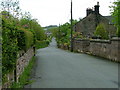
Hot Lane
This was one of the main roads through Biddulph Moor
Image: © Neil Lewin
Taken: 23 May 2006
0.09 miles
2
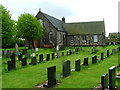
New Street Methodist Church, Biddulph Moor
Image: © Neil Lewin
Taken: 23 May 2006
0.09 miles
3
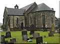
Christ Church- east end
Showing the semi-circular sanctuary at the east end of the parish church of Biddulph Moor, The church was built in 1863 from a design by the architect, John Lawton.
Image: © Jonathan Kington
Taken: 5 Jan 2011
0.14 miles
5
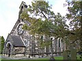
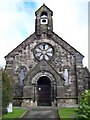
Christ Church, Biddulph Moor
The church dates from 1863
Image: © Geoff Pick
Taken: 31 Oct 2008
0.14 miles
6
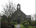
Christ Church- west end
The main entrance to Christ Church, the parish church for Biddulph Moor. The church was designed by the architect, John Lawton, and built in 1863. There appears to be a lovely rose window over the door but, unfortunately, the church is kept locked at all times.
Image: © Jonathan Kington
Taken: 5 Jan 2011
0.15 miles
7
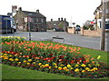
Rose and Crown, Biddulph Moor
A lovely stone-built pub located in the heart of the village. There is a very worn bench mark on the nearest corner (Image), for a close up of the sign see Image For another view see Image
Image: © Jonathan Kington
Taken: 23 Apr 2009
0.15 miles
8
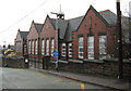
Biddulph Moor First School
This very imposing, brick built, school was built in 1909 as a new Council-run school. Possibly it replaced the former church run school that is now the Church Hall (Image), but that is only supposition on my part.
Image: © Jonathan Kington
Taken: 5 Jan 2011
0.15 miles
9
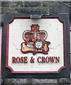
Sign for the Rose and Crown
This sign is attached to the wall of the Rose and Crown in Biddulph Moor (Image and Image). The rose is an interpretation of the Tudor Rose that is the combination of the red rose of Lancashire and the white rose of Yorkshire. The thirty years between 1455 and 1485 saw a lot of bitter fighting between the two counties for the right to the throne, known as the Wars of the Roses. The final battle was won by Henry Tudor, later known as Henry VII, who went on to marry Elizabeth of York in an attempt to reconcile the two factions. From this union the house of Tudor was founded, represented by the bi-coloured rose.
The crown has been a popular name, either on its own or linked with something else, for at least six hundred years. It was easy to paint and just as easy to recognise, it also declared an allegiance to the ruling monarch although during Cromwell's time in power after the Civil War it very rapidly disappeared- making just as quick a comeback after the Restoration.
Image: © Jonathan Kington
Taken: 5 Jan 2011
0.15 miles
10
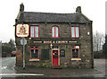
Rose and Crown
This delightful, stone built, pub stands in the centre of Biddulph Moor. There is a very worn benchmark on the left hand corner (Image), and for a close -up of the sign see Image For another view see Image
Image: © Jonathan Kington
Taken: 5 Jan 2011
0.15 miles