IMAGES TAKEN NEAR TO
Northfield Drive, STOKE-ON-TRENT, ST8 7DU
Introduction
This page details the photographs taken nearby to Northfield Drive, ST8 7DU by members of the Geograph project.
The Geograph project started in 2005 with the aim of publishing, organising and preserving representative images for every square kilometre of Great Britain, Ireland and the Isle of Man.

There are currently over 7.5m images from over14,400 individuals and you can help contribute to the project by visiting https://www.geograph.org.uk
Image Map
Images are licensed for reuse under creativecommons.org/licenses/by-sa/2.0
Notes
- Clicking on the map will re-center to the selected point.
- The higher the marker number, the further away the image location is from the centre of the postcode.
Image Listing (56 Images Found)
Images are licensed for reuse under creativecommons.org/licenses/by-sa/2.0
Image
Details
Distance
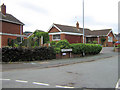
1
Sycamore Close
Taken from its junction with Greenway Road and looking towards its junction with Northfield Drive.
Image: © Jonathan Kington
Taken: 29 Aug 2010
0.03 miles
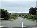
2
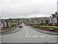
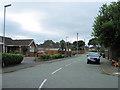
Northfield Drive
Looking up Northfield Drive from its junction with Carriage Drive and Greenway Road.
Image: © Jonathan Kington
Taken: 29 Aug 2010
0.03 miles
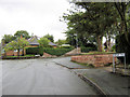
3
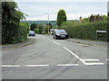
Kingston Place
A short cul-de-sac running off Pennine Way.
Image: © Jonathan Kington
Taken: 9 Aug 2010
0.04 miles
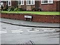
4
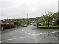
Looking up Crossways
Looking up Crossways from its junction with Carriage Drive towards the junction with Pennine Way shown in Image
Image: © Jonathan Kington
Taken: 29 Aug 2010
0.06 miles
5
Sign for Greenway Road
This is the name sign for Greenway Road (Image), at its junction with Woodhouse Lane.
Image: © Jonathan Kington
Taken: 9 Aug 2010
0.07 miles
6
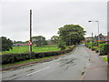
Looking down Crossways
Taken from its junction with Pennine Way, Crossways will eventually join Image Mow Cop castle is just visible in the far distance.
Image: © Jonathan Kington
Taken: 9 Aug 2010
0.07 miles
7
Greenway Road becomes Carriage Drive
At the junction with Northfield Drive, the road name changes from Greenway Road to Carriage Drive.
Image: © Jonathan Kington
Taken: 29 Aug 2010
0.07 miles
8
Sycamore Close sign
The name sign for Image at its junction with Greenway Road.
Image: © Jonathan Kington
Taken: 29 Aug 2010
0.07 miles
9
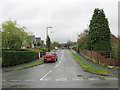
Greenway Road
Taken from its junction with Woodhouse Lane, Greenway Road eventually becomes Carriage Drive before emerging on Pennine Way (Image).
Image: © Jonathan Kington
Taken: 9 Aug 2010
0.07 miles
10
Woodhouse Lane
Looking up Woodhouse Lane from its junction with Greenway Road.
Image: © Jonathan Kington
Taken: 29 Aug 2010
0.07 miles