
IMAGES TAKEN NEAR TO
Chelsea Close, STOKE-ON-TRENT, ST8 6UA
Introduction
This page details the photographs taken nearby to Chelsea Close, ST8 6UA by members of the Geograph project.
The Geograph project started in 2005 with the aim of publishing, organising and preserving representative images for every square kilometre of Great Britain, Ireland and the Isle of Man.

There are currently over 7.5m images from over14,400 individuals and you can help contribute to the project by visiting https://www.geograph.org.uk
Image Map
Images are licensed for reuse under creativecommons.org/licenses/by-sa/2.0
Notes
- Clicking on the map will re-center to the selected point.
- The higher the marker number, the further away the image location is from the centre of the postcode.
Image Listing (57 Images Found)
Images are licensed for reuse under creativecommons.org/licenses/by-sa/2.0
Image
Details
Distance
1
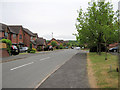
Smokies Way
Looking along Smokies Way from the junction with Station Road. The name comes from the old railway line that used to run parallel to it and behind the houses on the right.
Image: © Jonathan Kington
Taken: 26 May 2010
0.05 miles
2
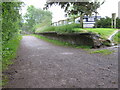
The old platform, Biddulph Station
Apart from a cottage just out of sight on the left, this is all that remains of what was once Biddulph Railway Station. The area to rear is now a carpark that opens onto the aptly named Smokies Way.
Image: © Jonathan Kington
Taken: 7 Jun 2009
0.05 miles
3
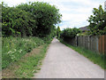
Biddulph Valley Way towards the old station
Looking north-east along Biddulph Valley Way, a disused railway line now a popular track for walkers, cyclists and horse-riders.
Image: © Jonathan Kington
Taken: 25 Jun 2010
0.06 miles
4
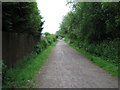
Biddulph Valley Way
Biddulph Valley Way follows the old railway line that runs from the former colliery at Chatterly Whitfield to Congleton. It is a very popular route for walkers, cyclists and horse riders. It is maintained by Staffordshire County Council and is part of Sustran's cycle route 55.
Image: © Jonathan Kington
Taken: 7 Jun 2009
0.06 miles
5
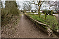
Biddulph Station (Disused), Biddulph Valley Way
Opened by the North Staffordshire Railway in 1864. Passenger traffic was withdrawn from the station on 11 July 1927, but freight traffic continued until 5 October 1964.
https://en.wikipedia.org/wiki/Biddulph_railway_station
Image: © Brian Deegan
Taken: 11 Feb 2023
0.07 miles
6
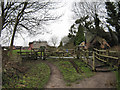
The old station
Across the road from here, on the Biddulph Valley Way, was the old Biddulph Railway Station- the remains of the platform can be seen here Image There would have originally been a level-crossing here and the house on the right would have probably been the crossing keeper's dwelling. See also Ben Brooksbank's excellent picture taken in 1962: Image
Image: © Jonathan Kington
Taken: 19 Jan 2010
0.07 miles
7
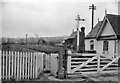
Biddulph Station (remains)
View southward, towards Ford Green and Stoke; Stoke-on-Trent - Ford Green - North Rode (Biddulph Valley) line. Station and line closed to passengers long ago (11/7/27), but station not closed to goods until 5/10/64 and mineral trains ran over this stretch until 1/76.
Image: © Ben Brooksbank
Taken: 20 Apr 1962
0.07 miles
8
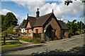
Biddulph Station
Station buildings at Biddulph Station.
Image: © Peter McDermott
Taken: 13 Jul 2023
0.08 miles
9
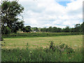
Looking towards Holly Lane
Looking across the field adjacent to the Biddulph Valley Way to Holly Lane marked by the hedge. The buildings on the other side of the lane belong to a farm called The Falls.
Image: © Jonathan Kington
Taken: 25 Jun 2010
0.09 miles
10
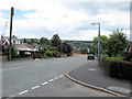
Looking east along Station Road
Station Road from its junction with Image to the junction with Halls Road. See also Image, Image, Image and Image
Image: © Jonathan Kington
Taken: 25 Jun 2010
0.09 miles