
IMAGES TAKEN NEAR TO
Nursery Drive, STOKE-ON-TRENT, ST8 6RE
Introduction
This page details the photographs taken nearby to Nursery Drive, ST8 6RE by members of the Geograph project.
The Geograph project started in 2005 with the aim of publishing, organising and preserving representative images for every square kilometre of Great Britain, Ireland and the Isle of Man.

There are currently over 7.5m images from over14,400 individuals and you can help contribute to the project by visiting https://www.geograph.org.uk
Image Map
Images are licensed for reuse under creativecommons.org/licenses/by-sa/2.0
Notes
- Clicking on the map will re-center to the selected point.
- The higher the marker number, the further away the image location is from the centre of the postcode.
Image Listing (43 Images Found)
Images are licensed for reuse under creativecommons.org/licenses/by-sa/2.0
Image
Details
Distance
1
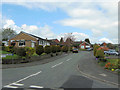
Nursery Drive
One of several cul-de-sacs that run off Long Valley Drive (see Image), the name probably comes from the nearby Plant Centre (Image).
Image: © Jonathan Kington
Taken: 25 Apr 2010
0.03 miles
2
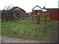
Path to Long Valley Road
This path leads from the former railway line that is now the Biddulph Valley Way to give access to Long Valley Road.
Image: © Jonathan Kington
Taken: 29 Dec 2010
0.05 miles
3
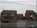
Monkey Puzzle Court, Gillow Heath
The unusual name of this housing development off Well Lane may refer to a tree that stood on the site - or could have a completely different origin! It appeared to be a recent development, as at the time of submission (2011) an aerial photography website still showed it undeveloped.
Image: © Stephen Craven
Taken: 30 Dec 2010
0.06 miles
4
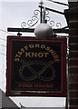
Sign for the Staffordshire Knot
The Image is located on the junction of Well Lane and Marshfield Lane in Gillow Heath.
The knot is more properly known as the Stafford Knot and, although not a heraldic device in its own right, has been used on coats of arms throughout the county of Staffordshire. There is a seal existing in the British Museum London which was the property of Lady Joan Stafford (later to become Lady Wake). It would seem that Lady Wake used on her seal a border made up from her husband's badge, the Wake Knot, made up from the initials W and O (for Wake and Ormond) intertwined. The seal quite clearly depicts a cordon of four knots in the shape of the Stafford Knot. The knot was handed down through the Earl's family, and it was gradually used by the citizens and freemen of Stafford, until it was eventually included in the Stafford Borough Coat of Arms. It is incorporated into the badges and symbols of many organisations and companies, including the Police, Fire Service and Ambulance Service. It was also used for many years by the Stoke-on-Trent potters as part of their marks on the bases of chinaware.
There is a fanciful tale that the Knot was originally created by a Sherrif of Staffordshire who wanted to hang three men at once, but this is a bit far-fetched.
Image: © Jonathan Kington
Taken: 10 Nov 2010
0.08 miles
5
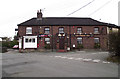
Staffordshire Knot
A popular pub located on the junction of Well Lane and Marshfield Lane in Gillow Heath. The white windows to the left belong to a hairdressing salon called Sophisticut. For a picture of the sign and information on the origins of the name see Image
Image: © Jonathan Kington
Taken: 10 Nov 2010
0.08 miles
6
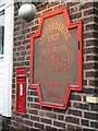
Postbox and inn sign on the Staffordshire Knot
A Victorian post box and the pub sign on the wall of the pub Image I could not get a full-on view as there was a van parked adjacent.
Image: © Stephen Craven
Taken: 30 Dec 2010
0.08 miles
7
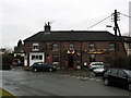
The Staffordshire Knot
For more information about this pub in Gillow Heath, see Image It proved to be a very friendly family "local".
Image: © Stephen Craven
Taken: 30 Dec 2010
0.08 miles
8
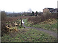
To York Close
This short path leads from the former railway line that is now the Biddulph Valley Way, across some waste ground to York Close.
Image: © Jonathan Kington
Taken: 29 Dec 2010
0.08 miles
9
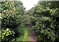
Looking down onto the Biddulph Valley Way
Looking from Image on Mow Lane to the former Biddulph Valley Railway that has been converted into a very popular track for cyclists, walkers and horse-riders.
Image: © Jonathan Kington
Taken: 22 Sep 2010
0.09 miles
10
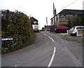
City Bank
Viewed from its junction with Well Lane, City Bank is a short cul-de-sac with a former textile mill located at the top. I can find no information on UK Workwear, I hope this does not mean that they are no longer trading.
Image: © Jonathan Kington
Taken: 10 Nov 2010
0.10 miles