IMAGES TAKEN NEAR TO
Whetstone Road, STOKE-ON-TRENT, ST8 6QF
Introduction
This page details the photographs taken nearby to Whetstone Road, ST8 6QF by members of the Geograph project.
The Geograph project started in 2005 with the aim of publishing, organising and preserving representative images for every square kilometre of Great Britain, Ireland and the Isle of Man.

There are currently over 7.5m images from over14,400 individuals and you can help contribute to the project by visiting https://www.geograph.org.uk
Image Map
Images are licensed for reuse under creativecommons.org/licenses/by-sa/2.0
Notes
- Clicking on the map will re-center to the selected point.
- The higher the marker number, the further away the image location is from the centre of the postcode.
Image Listing (40 Images Found)
Images are licensed for reuse under creativecommons.org/licenses/by-sa/2.0
Image
Details
Distance
2
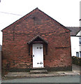
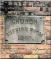
Church Mission Room
This Mission Room is located on Well Lane and was built in 1900, there is very little information on this building but I imagine it was (or is) used for Church social events. For a view of the date-stone see Image and for another view from a different angle see Image
Image: © Jonathan Kington
Taken: 10 Nov 2010
0.07 miles
3
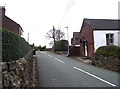
Well Lane
Looking along Well Lane from its junction with Mow Lane. The red and white building on the right is another view of the Image
Image: © Jonathan Kington
Taken: 10 Nov 2010
0.08 miles
4
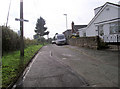
Cecil Road
Viewed from its junction with Mow Lane, adjacent to Image, Cecil Road is a short cul-de-sac that runs parallel with the Biddulph Valley Way.
Image: © Jonathan Kington
Taken: 22 Sep 2010
0.10 miles
5
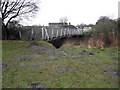
Bridge in Gillow Heath
This footbridge, crossing the Biddulph Valley Way, connects Sandsdown Close and Halls Road Playing Fields to Washington Close.
Image: © Jonathan Kington
Taken: 29 Dec 2010
0.10 miles
6
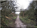
Footbridge over the Biddulph Valley Way
This footbridge crosses from the playing fields on the left to a housing estate in Gillow Heath on the right.
Image: © Jonathan Kington
Taken: 19 Jan 2010
0.12 miles
7
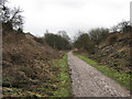
Looking North-East along the Biddulph Valley Way
Originally a railway line this now a very popular bridleway known as the Biddulph Valley Way.
Image: © Jonathan Kington
Taken: 19 Jan 2010
0.12 miles
8
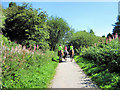
Riders on the Biddulph Valley Way
The former railway line that is now the Biddulph Valley Way is a very popular route for walkers, cyclists and horse riders, especially on a sunny day in August.
Image: © Jonathan Kington
Taken: 16 Aug 2010
0.12 miles
9
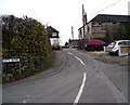
City Bank
Viewed from its junction with Well Lane, City Bank is a short cul-de-sac with a former textile mill located at the top. I can find no information on UK Workwear, I hope this does not mean that they are no longer trading.
Image: © Jonathan Kington
Taken: 10 Nov 2010
0.12 miles