
IMAGES TAKEN NEAR TO
Briarswood, STOKE-ON-TRENT, ST8 6BW
Introduction
This page details the photographs taken nearby to Briarswood, ST8 6BW by members of the Geograph project.
The Geograph project started in 2005 with the aim of publishing, organising and preserving representative images for every square kilometre of Great Britain, Ireland and the Isle of Man.

There are currently over 7.5m images from over14,400 individuals and you can help contribute to the project by visiting https://www.geograph.org.uk
Image Map
Images are licensed for reuse under creativecommons.org/licenses/by-sa/2.0
Notes
- Clicking on the map will re-center to the selected point.
- The higher the marker number, the further away the image location is from the centre of the postcode.
Image Listing (144 Images Found)
Images are licensed for reuse under creativecommons.org/licenses/by-sa/2.0
Image
Details
Distance
1

Modern Waymarker, A527, Meadows Way, Biddulph
The modern waymarker is located 70m north east of the Briarswood junction, on the verge in front of the wooden fence. Parish of Biddulph (Staffordshire Moorlands District). For a later photograph, see https://www.geograph.org.uk/photo/6994455
Inscription reads:-
BIDDULPH / A.527 / CONGLETON / 4 MILES {arrow->} / NEWCASTLE / {<-arrow} 9 MILES
Milestone Society National ID: ST_NCCO09A
Image: © Milestone Society
Taken: Unknown
0.03 miles
2
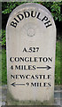
Milestone on Meadows Way
Completed in 2003, Meadows Way was constructed as an "inner by-pass" for Biddulph. For some reason somebody decided that a milestone would be a good idea, even though an older one is marked on the map about five hundred yards away (Image).
Image: © Jonathan Kington
Taken: 30 Aug 2010
0.03 miles
3
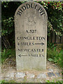
Modern Milestone, A527
Biddulph, NW side of road.
Biddulph / A.527 / Congleton / 4 Miles / Newcastle / 9 Miles
Milestone Society National ID: TBC
Image: © Ivan Clare
Taken: 18 Oct 2021
0.03 miles
4
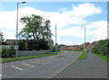
Looking towards Briarswood
Looking along Meadows Way towards its junction with Briarswood.
Image: © Jonathan Kington
Taken: 30 Aug 2010
0.04 miles
5
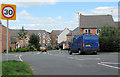
Down Briarswood
Looking down Briarswood from its junction with Meadows Way.
Image: © Jonathan Kington
Taken: 30 Aug 2010
0.05 miles
6
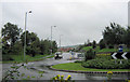
West on Meadows Way
Looking along Meadows Way from the roundabout on Congleton Road.
Image: © Jonathan Kington
Taken: 29 Aug 2010
0.06 miles
7
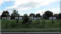
Caravan storage
A secure caravan storage park near Meadows Way.
Image: © Jonathan Kington
Taken: 30 Aug 2010
0.07 miles
8
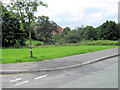
Grassland near Field View
A nice patch of amenity grassland running down to the stream between the houses on Field View and Halls Road.
Image: © Jonathan Kington
Taken: 2 Aug 2010
0.08 miles
9
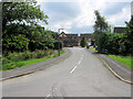
Field View
Looking up Field View from its junction with Halls Road at Image
Image: © Jonathan Kington
Taken: 2 Aug 2010
0.09 miles
10
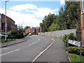
Brocks Croft Gardens
Looking along Brocks Croft Gardens from its junction with Briarswood.
Image: © Jonathan Kington
Taken: 30 Aug 2010
0.09 miles