
IMAGES TAKEN NEAR TO
Hall Green Drive, STOKE-ON-TRENT, ST7 3UX
Introduction
This page details the photographs taken nearby to Hall Green Drive, ST7 3UX by members of the Geograph project.
The Geograph project started in 2005 with the aim of publishing, organising and preserving representative images for every square kilometre of Great Britain, Ireland and the Isle of Man.

There are currently over 7.5m images from over14,400 individuals and you can help contribute to the project by visiting https://www.geograph.org.uk
Image Map
Images are licensed for reuse under creativecommons.org/licenses/by-sa/2.0
Notes
- Clicking on the map will re-center to the selected point.
- The higher the marker number, the further away the image location is from the centre of the postcode.
Image Listing (42 Images Found)
Images are licensed for reuse under creativecommons.org/licenses/by-sa/2.0
Image
Details
Distance
1
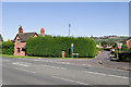
Little Moss Lane
Junction of Little Moss Lane with Congleton Road North. In the background can be seen Mow Cop Folly, above Mow Cop.
Image: © Ian Capper
Taken: 4 Oct 2010
0.13 miles
3
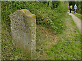
Canal milestone, south side
According to the canal society's website, these stones resembling grave markers are unique to the Macclesfield and Cromford canals. The Macclesfield's milestones had mostly been buried during the second world war as a precaution against enemy soldiers using them to find their way. All but three stones were dug up and re-erected by volunteers in the 1980s. This one, showing "From Marple 26 miles" on its southern face, is listed grade II (list entry 1138712).
Image: © Stephen Craven
Taken: 1 Aug 2020
0.16 miles
4
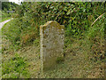
Canal milestone, north side
According to the canal society's website, these stones resembling grave markers are unique to the Macclesfield and Cromford canals. The Macclesfield's milestones had mostly been buried during the second world war as a precaution against enemy soldiers using them to find their way. All but three stones were dug up and re-erected by volunteers in the 1980s. This one, showing "Hall Green 1/4 mile" on its northern face, is listed grade II (list entry 1138712).
Image: © Stephen Craven
Taken: 1 Aug 2020
0.16 miles
5
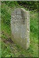
Old milemarker by the Macclesfield Canal, Odd Rode
Milemarker by the Macclesfield Canal, in parish of Odd Rode (Congleton District).
Inscription reads:-
: From / Marple / 26 Miles : : From / Hall Green / ¼ Mile :
Grade II listed.
List Entry Number: 1138712 https://historicengland.org.uk/listing/the-list/list-entry/1138712
Surveyed
Milestone Society National ID: MAC-26
Image: © Milestone Society
Taken: Unknown
0.16 miles
6
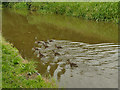
Speedy ducks
These nine female mallards had been swimming serenely, until someone up ahead starting throwing bread into the canal.
Image: © Stephen Craven
Taken: 1 Aug 2020
0.17 miles
7
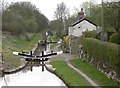
Hall Green Stop
This is the start of the Macclesfield Canal at Hall Green Stop Lock. Beyond lies the Hall Green branch of the Trent & Mersey Canal.
Image: © David Kitching
Taken: 9 Apr 2003
0.17 miles
8
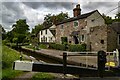
Macclesfield Canal
Lock keeper's cottage on the Macclesfield Canal at Hall Green.
Image: © Peter McDermott
Taken: 13 Jul 2023
0.17 miles
9
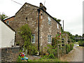
Lock-keeper's house at Hall Green
This is adjacent to the stop lock that marks the original terminus of the canal Image
Image: © Stephen Craven
Taken: 1 Aug 2020
0.17 miles
10

Macclesfield Canal: Footbridge No 93 and Hall Green Stop Lock
Technically the Macclesfield Canal ends at this stop lock: the property boundary between the Macclesfield and the Trent & Mersey Canals being midway between the top and bottom gates of the lock. However, bridge numbering continues in the Macclesfield series until the Hardingswood Junction is reached.
Image: © Dr Neil Clifton
Taken: 1 Apr 2015
0.17 miles