
IMAGES TAKEN NEAR TO
Street Lane, STOKE-ON-TRENT, ST7 3SW
Introduction
This page details the photographs taken nearby to Street Lane, ST7 3SW by members of the Geograph project.
The Geograph project started in 2005 with the aim of publishing, organising and preserving representative images for every square kilometre of Great Britain, Ireland and the Isle of Man.

There are currently over 7.5m images from over14,400 individuals and you can help contribute to the project by visiting https://www.geograph.org.uk
Image Map
Images are licensed for reuse under creativecommons.org/licenses/by-sa/2.0
Notes
- Clicking on the map will re-center to the selected point.
- The higher the marker number, the further away the image location is from the centre of the postcode.
Image Listing (7 Images Found)
Images are licensed for reuse under creativecommons.org/licenses/by-sa/2.0
Image
Details
Distance
1
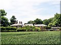
Boden Hall
Odd Rode, Boden Hall seen across cereal crop from the South Cheshire Way.
Image: © Mike Harris
Taken: 8 Jun 2008
0.02 miles
2
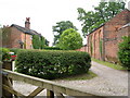
Cottages and outbuilding at Boden Hall
The South Cheshire Way runs between Lynton Cottages on the left and the fine brick building on the right.
Image: © Derek Harper
Taken: 30 Jun 2006
0.03 miles
3
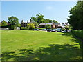
Boden Hall and outbuildings from the north
Image: © Richard Law
Taken: 6 Jun 2013
0.04 miles
4
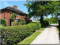
Cottages at Boden Hall
From the South Cheshire Way footpath that runs through the outer part of the hall's buildings; these two cottages are well kept, attractive residences.
Image: © Richard Law
Taken: 6 Jun 2013
0.04 miles
5
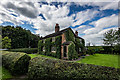
Ivy Covered Cottage, South Cheshire Way, Boden
Image: © Brian Deegan
Taken: 31 Aug 2020
0.06 miles
6
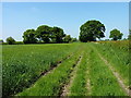
South Cheshire Way east of Boden Hall
A field-edge path which takes a sharp left-hander around the wheatfield at the oak trees dead ahead.
Image: © Richard Law
Taken: 6 Jun 2013
0.12 miles
7
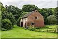
Cracking Barn, Forge Farm, South Cheshire Way
Image: © Brian Deegan
Taken: 31 Aug 2020
0.25 miles