
IMAGES TAKEN NEAR TO
Sandbach Road North, STOKE-ON-TRENT, ST7 3RG
Introduction
This page details the photographs taken nearby to Sandbach Road North, ST7 3RG by members of the Geograph project.
The Geograph project started in 2005 with the aim of publishing, organising and preserving representative images for every square kilometre of Great Britain, Ireland and the Isle of Man.

There are currently over 7.5m images from over14,400 individuals and you can help contribute to the project by visiting https://www.geograph.org.uk
Image Map
Images are licensed for reuse under creativecommons.org/licenses/by-sa/2.0
Notes
- Clicking on the map will re-center to the selected point.
- The higher the marker number, the further away the image location is from the centre of the postcode.
Image Listing (24 Images Found)
Images are licensed for reuse under creativecommons.org/licenses/by-sa/2.0
Image
Details
Distance
1
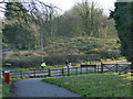
Eastern end of the Salt Line at Lawton Heath
The bridge that once carried the railway over Sandbach Road North has been demolished. The cycle trail ends here as an off-road route, continuing on the minor road opposite to join the towpath of the Trent and Mersey Canal nearby.
Image: © Stephen Craven
Taken: 30 Dec 2019
0.05 miles
2
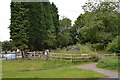
South-eastern end of Salt Line trail
Viewed from Sandbach Road North, with Bridge Farm on the left.
Image: © Jonathan Hutchins
Taken: 12 Jul 2015
0.06 miles
4
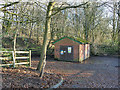
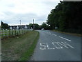
Lawton Heath End WWPS
A Waste Water Pumping Station next to Sandbach Road North. To the left is the embankment of a former railway line.
Image: © Stephen Craven
Taken: 30 Dec 2019
0.09 miles
6
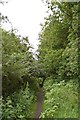
Path along Salt Line
The trail officially ends at its junction with Sandbach Road North http://www.geograph.org.uk/photo/4568120. The embanked former railway line, here still just about navigable on foot, continues south-eastwards towards its former junction with the main Crewe-Derby line east of Alsager.
Image: © Jonathan Hutchins
Taken: 12 Jul 2015
0.09 miles
7
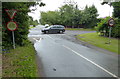
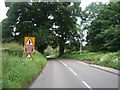
Betchton Lane junction at Lawton Heath End
Image: © Mat Fascione
Taken: 11 Jul 2015
0.10 miles
8
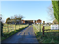
Bridge Farm, Lawton Heath
The dairy farm is named after a railway bridge that has now been demolished.
Image: © Stephen Craven
Taken: 30 Dec 2019
0.10 miles
9
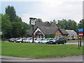
Wilbraham Arms Alsager
The first pub as you enter Alsager from the M6 at Sandbach.
Built on the site of Cresswellshawe Farm and named after the Wilbraham family major landowners of part of Alsager in days gone by.
Image: © Dennis Thorley
Taken: 11 Jul 2005
0.12 miles
10
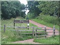
Salt Line Alsager
The Salt Line is now a linear nature trail and cycleway starting near to the Wilbraham Arms in Alsager.
It follows the old mineral line from the Potteries through to Sandbach and the salt towns of S Cheshire.
Coal and limestone was carried into Cheshire where brine was heated in large open pans to leave white salt crystals which were then used in the making of washing soda, glass, soap and detergents.
The Salt Line is now in the ownership of Congleton Borough Council.
Image: © Dennis Thorley
Taken: 11 Jul 2005
0.12 miles