
IMAGES TAKEN NEAR TO
Marshes Hill, STOKE-ON-TRENT, ST6 8UF
Introduction
This page details the photographs taken nearby to Marshes Hill, ST6 8UF by members of the Geograph project.
The Geograph project started in 2005 with the aim of publishing, organising and preserving representative images for every square kilometre of Great Britain, Ireland and the Isle of Man.

There are currently over 7.5m images from over14,400 individuals and you can help contribute to the project by visiting https://www.geograph.org.uk
Image Map
Images are licensed for reuse under creativecommons.org/licenses/by-sa/2.0
Notes
- Clicking on the map will re-center to the selected point.
- The higher the marker number, the further away the image location is from the centre of the postcode.
Image Listing (10 Images Found)
Images are licensed for reuse under creativecommons.org/licenses/by-sa/2.0
Image
Details
Distance
1
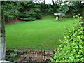
Standing Stones
built in the late 20th or early 21st century. The stone wall in the foreground is a culvert through which a stream runs.
Image: © Neil Lewin
Taken: 25 Aug 2006
0.10 miles
2
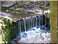
Waterfall at Greenway Bank
Waterfall over dam built to feed leat to fill Serpentine pool
Image: © Howard Lawton
Taken: 6 May 2008
0.14 miles
3

Small pond looking towards Ladymoor Farm
Image: © Chris Wimbush
Taken: 20 Aug 2010
0.16 miles
4
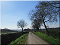
Countryside north of Brown Edge
An area of narrow lanes between Brown Edge and Biddulph.
Image: © David Weston
Taken: 8 Apr 2017
0.20 miles
5
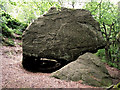
Another view of Gawton's Rock
An opposite view to Image showing the alcove where the hermit is reputed to have made his home.
Image: © Jonathan Kington
Taken: 9 Jun 2011
0.23 miles
6
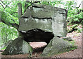
Gawton's Rock
Also known as Gawton's Dolmen and The Healing Stone this arrangement of boulders seems to be shrouded in mystery. Some will tell you that a sort of "energy" can be felt when it is touched, others say there is evidence that a hermit was once healed at the nearby Gawton's Well and then lived in the alcove between the supporting stones to the rear of the rock. It could also have been erected by the owners of the estate during the reign of Queen Victoria (who were called Gawton), creating structures like this was very much in fashion then. Of course, it could have occurred naturally- the large stone breaking away from the rock face behind and coming to rest on the smaller rocks. Who knows? See also http://www.megalithic.co.uk/article.php?sid=26214 for more theories.
Image: © Jonathan Kington
Taken: 5 Jun 2011
0.23 miles
7
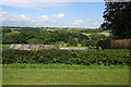
Countryside near Greenway Bank Country Park
View from the upper car park at the country park. Knypersley Reservoir lies in the valley just beyond the trees in the centre of the photograph. The hills in the distance are almost in the next square east.
Image: © Kate Jewell
Taken: 11 Jun 2008
0.24 miles
8
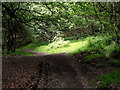
Spotlight on the junction
A gap in the tree canopy allows the sun to spotlight the track junction near Image
Image: © Jonathan Kington
Taken: 9 Jun 2011
0.25 miles
9
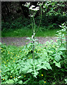
Common Hogweed
This Common Hogweed (Heracleum sphondylium) plant is growing on the track junction seen in Image For more information and a close-up of one of the umbels, or flowerheads, see Image There are also some Creeping Buttercup on the ground below it.
Image: © Jonathan Kington
Taken: 9 Jun 2011
0.25 miles
10
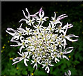
Flowers of the Common Hogweed
This is one of the flowerheads or umbels of the plant seen growing in Image
The Common Hogweed (Heracleum sphondylium) is a common, invasive plant that can be found under hedges, in woodland and on road verges. It is a member of the carrot family (Apiaceae) that when given good growing conditions can grow to height of two metres. The flat shape of the flowerheads give it the classification of Umbellifer, with each separate head being an umbel. Certain parts of the plant are edible, for more information see http://www.celtnet.org.uk/recipes/ancient/wild-food-entry.php?term=Common%20Hogweed .
Image: © Jonathan Kington
Taken: 9 Jun 2011
0.25 miles