
IMAGES TAKEN NEAR TO
The Orchard, STOKE-ON-TRENT, ST6 8RE
Introduction
This page details the photographs taken nearby to The Orchard, ST6 8RE by members of the Geograph project.
The Geograph project started in 2005 with the aim of publishing, organising and preserving representative images for every square kilometre of Great Britain, Ireland and the Isle of Man.

There are currently over 7.5m images from over14,400 individuals and you can help contribute to the project by visiting https://www.geograph.org.uk
Image Map
Images are licensed for reuse under creativecommons.org/licenses/by-sa/2.0
Notes
- Clicking on the map will re-center to the selected point.
- The higher the marker number, the further away the image location is from the centre of the postcode.
Image Listing (14 Images Found)
Images are licensed for reuse under creativecommons.org/licenses/by-sa/2.0
Image
Details
Distance
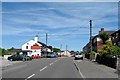

3
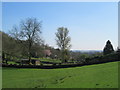
St Anne's Vale, Brown Edge
View near the road, called St Anne's Vale, going south-east from St Anne's Church.
Image: © David Weston
Taken: 8 Apr 2017
0.15 miles
4
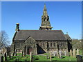
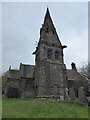
St Anne's Church, Brown Edge
Viewed from the south.
Image: © David Weston
Taken: 8 Apr 2017
0.18 miles
5

St. Anne Church, Brown Edge
Our beautiful church is dedicated to St. Anne, the mother of Mary, and the grandmother of our Lord Jesus. It is built on a hillock in a village of about 2500 residents.
While certain parts of its architecture lead visitors to imagine that it is ancient, in fact it was built in the Victorian era
Image: © Brian Deegan
Taken: 24 Aug 2013
0.19 miles
6
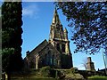
St. Anne, Brown Edge
A church with commanding views of the local area
Image: © Geoff Pick
Taken: 31 Oct 2008
0.19 miles
8
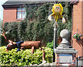
Scooby and Shaggy
by Jake and Jamie aged 2 & 8 yrs old. (it says so on the sign)
Image: © Neil Lewin
Taken: 19 Jul 2007
0.21 miles
9
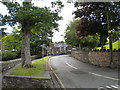
St Anne's Vale, Brown Edge
A narrow road around the back of St Anne's Church (out of frame on the right). One of the school buildings can be seen near the middle of the picture.
Image: © Richard Vince
Taken: 29 Jun 2013
0.21 miles
10
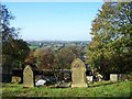
View From Churchyard, St. Anne, Brown Edge
Image: © Geoff Pick
Taken: 31 Oct 2008
0.22 miles