IMAGES TAKEN NEAR TO
Sandbach Road, STOKE-ON-TRENT, ST6 2DU
Introduction
This page details the photographs taken nearby to Sandbach Road, ST6 2DU by members of the Geograph project.
The Geograph project started in 2005 with the aim of publishing, organising and preserving representative images for every square kilometre of Great Britain, Ireland and the Isle of Man.

There are currently over 7.5m images from over14,400 individuals and you can help contribute to the project by visiting https://www.geograph.org.uk
Image Map
Images are licensed for reuse under creativecommons.org/licenses/by-sa/2.0
Notes
- Clicking on the map will re-center to the selected point.
- The higher the marker number, the further away the image location is from the centre of the postcode.
Image Listing (22 Images Found)
Images are licensed for reuse under creativecommons.org/licenses/by-sa/2.0
Image
Details
Distance
2
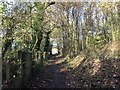
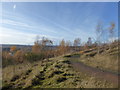
Path below hill at Sneyd Hill Park
Image: © Jonathan Hutchins
Taken: 19 Nov 2016
0.05 miles
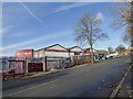
3
Burslem: junction of Sneyd Hill and Nevada Lane
Image: © Jonathan Hutchins
Taken: 19 Nov 2016
0.07 miles
4
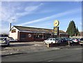
Burslem: Captain Kooks on Sandbach Road
A fish and chip takeaway and diner.
Image: © Jonathan Hutchins
Taken: 19 Nov 2016
0.13 miles
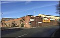
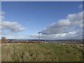
5
Industrial estates at Burslem, viewed from Sneyd Hill Park
Image: © Jonathan Hutchins
Taken: 19 Nov 2016
0.14 miles
6
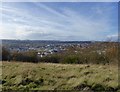
Sneyd Hill Park
Climbing the hill. Burslem can be seen below the hill to the north-west.
Image: © Jonathan Hutchins
Taken: 19 Nov 2016
0.15 miles
7
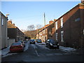
Open area, Fraser Street, Stoke-on-Trent
Image: © Alex McGregor
Taken: 22 Jun 2011
0.17 miles
9
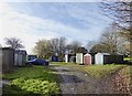
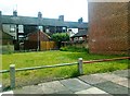
Garages behind Adkins Street, Cobridge
Image: © Jonathan Hutchins
Taken: 19 Nov 2016
0.18 miles
10
Cross on the summit of Sneyd Hill Park
Image: © Jonathan Hutchins
Taken: 19 Nov 2016
0.18 miles