IMAGES TAKEN NEAR TO
Collard Avenue, NEWCASTLE, ST5 9LH
Introduction
This page details the photographs taken nearby to Collard Avenue, ST5 9LH by members of the Geograph project.
The Geograph project started in 2005 with the aim of publishing, organising and preserving representative images for every square kilometre of Great Britain, Ireland and the Isle of Man.

There are currently over 7.5m images from over14,400 individuals and you can help contribute to the project by visiting https://www.geograph.org.uk
Image Map
Images are licensed for reuse under creativecommons.org/licenses/by-sa/2.0
Notes
- Clicking on the map will re-center to the selected point.
- The higher the marker number, the further away the image location is from the centre of the postcode.
Image Listing (36 Images Found)
Images are licensed for reuse under creativecommons.org/licenses/by-sa/2.0
Image
Details
Distance
1
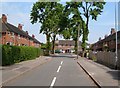
Linden Close, Cross Heath
Tall trees tower above a cul-de-sac off Linden Grove, north of Newcastle-Under-Lyme.
Image: © Derek Harper
Taken: 30 Jun 2006
0.04 miles
2
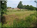
Hempstalls Primary School
Seen across the Lyme Brook, hidden among vegetation at the bottom of the gully.
Image: © Derek Harper
Taken: 30 Jun 2006
0.07 miles
3
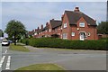
St Michael's Road, Cross Heath
The junction with Collard Avenue (right). In about 170 metres, the road meets the main A34 Liverpool Road.
Image: © Derek Harper
Taken: 30 Jun 2006
0.11 miles
4
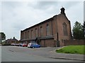
Newcastle-under-Lyme: Church of St Michael and All Angels, Cross Heath
Built in 1954, architect Andrew Capper. Though part of the Diocese of Lichfield, the parish is under the Provincial Episcopal Visitor, the Bishop of Ebbsfleet, and is a Forward in Faith Parish.
Image: © Jonathan Hutchins
Taken: 28 May 2016
0.11 miles
5
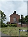
Newcastle-under-Lyme: Church of St Michael and All Angels, Cross Heath
Built in 1954, architect Andrew Capper. Though part of the Diocese of Lichfield, the parish is under the Provincial Episcopal Visitor, the Bishop of Ebbsfleet, and is a Forward in Faith Parish.
Image: © Jonathan Hutchins
Taken: 28 May 2016
0.12 miles
6
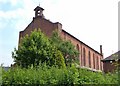
St Michael & All Angels church, Cross Heath
An Anglican church with adjoining Presbytery at the junction of Liverpool Road and Linden Grove.
Image: © Derek Harper
Taken: 30 Jun 2006
0.13 miles
7
Newcastle-under-Lyme: junction of Linden Grove and A34
Image: © Jonathan Hutchins
Taken: 28 May 2016
0.14 miles
8
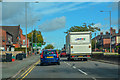
Newcastle-Under-Lyme : Liverpool Road A34
Looking along Liverpool Road.
Image: © Lewis Clarke
Taken: 23 Sep 2019
0.15 miles
9
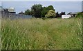
Footpath, Cross Heath
An obscure and obviously little-used public footpath that links Brackenberry to the Liverpool Road. Here it is running along the back of the TA Centre (left), with a van outside an upholstery business on St Michael's Road.
Image: © Derek Harper
Taken: 30 Jun 2006
0.15 miles