IMAGES TAKEN NEAR TO
Valentine Way, NEWCASTLE, ST5 9FJ
Introduction
This page details the photographs taken nearby to Valentine Way, ST5 9FJ by members of the Geograph project.
The Geograph project started in 2005 with the aim of publishing, organising and preserving representative images for every square kilometre of Great Britain, Ireland and the Isle of Man.

There are currently over 7.5m images from over14,400 individuals and you can help contribute to the project by visiting https://www.geograph.org.uk
Image Map (Loading...)


Getting Data...Please wait
Leaflet Map data © OpenStreetMap
Images are licensed for reuse under creativecommons.org/licenses/by-sa/2.0
Notes
- Clicking on the map will re-center to the selected point.
- The higher the marker number, the further away the image location is from the centre of the postcode.
Image Listing (34 Images Found)
Images are licensed for reuse under creativecommons.org/licenses/by-sa/2.0
Image
Details
Distance
1
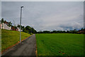
Newcastle-Under-Lyme : The Wammy
A path through The Wammy.
Image: © Lewis Clarke
Taken: 22 Sep 2019
0.06 miles
2
Newcastle-Under-Lyme : The Wammy
Looking along a footpath through The Wammy.
Image: © Lewis Clarke
Taken: 22 Sep 2019
0.06 miles
3
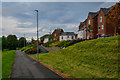
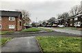
Newcastle-under-Lyme: Ronaldsway Drive
Image: © Jonathan Hutchins
Taken: 11 Feb 2017
0.07 miles
4
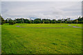
Newcastle-Under-Lyme : The Wammy
A grassy space for rest and play.
Image: © Lewis Clarke
Taken: 22 Sep 2019
0.07 miles
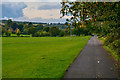
5
Newcastle-Under-Lyme : The Wammy
Looking along The Wammy.
Image: © Lewis Clarke
Taken: 22 Sep 2019
0.08 miles
6
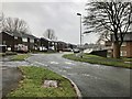
Newcastle-under-Lyme: Tynwald Grange
Image: © Jonathan Hutchins
Taken: 11 Feb 2017
0.08 miles
7
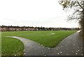
Newcastle-under-Lyme: The Wammy
The Wammy is a neighbourhood park on the edge of Newcastle, developed in phases and currently comprising a cycleway, one mini and two adult football pitches, car parking and a natural play area.
In the background on the left are the backs of houses on St Bernard's Road in Knutton.
Image: © Jonathan Hutchins
Taken: 20 Nov 2016
0.08 miles
8
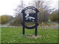
Newcastle-under-Lyme: sign for The Wammy
The Wammy is a neighbourhood park on the edge of Newcastle, developed in phases and currently comprising a cycleway, one mini and two adult football pitches, car parking and a natural play area.
Image: © Jonathan Hutchins
Taken: 20 Nov 2016
0.11 miles
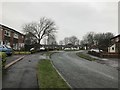
9
Newcastle-under-Lyme: Tynwald Grange
The opposite (cul-de-sac) end from http://www.geograph.org.uk/photo/5279349
Image: © Jonathan Hutchins
Taken: 11 Feb 2017
0.12 miles
10
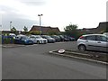
Milehouse Primary Care Centre car park
Image: © Jonathan Hutchins
Taken: 5 Jun 2015
0.12 miles