IMAGES TAKEN NEAR TO
Wilmot Drive, NEWCASTLE, ST5 9AZ
Introduction
This page details the photographs taken nearby to Wilmot Drive, ST5 9AZ by members of the Geograph project.
The Geograph project started in 2005 with the aim of publishing, organising and preserving representative images for every square kilometre of Great Britain, Ireland and the Isle of Man.

There are currently over 7.5m images from over14,400 individuals and you can help contribute to the project by visiting https://www.geograph.org.uk
Image Map
Images are licensed for reuse under creativecommons.org/licenses/by-sa/2.0
Notes
- Clicking on the map will re-center to the selected point.
- The higher the marker number, the further away the image location is from the centre of the postcode.
Image Listing (12 Images Found)
Images are licensed for reuse under creativecommons.org/licenses/by-sa/2.0
Image
Details
Distance
1
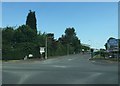
Newcastle-under-Lyme: crossroads in Cross Heath
Image: © Jonathan Hutchins
Taken: 6 Jun 2016
0.13 miles

3
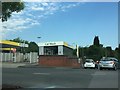
Newcastle-under-Lyme: Morrisons car wash, Cross Heath
Image: © Jonathan Hutchins
Taken: 6 Jun 2016
0.15 miles
4
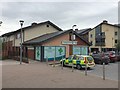
Milehouse Primary Care Centre: pharmacy
Image: © Jonathan Hutchins
Taken: 5 Jun 2015
0.16 miles
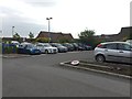
5
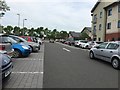
Milehouse Primary Care Centre car park
Image: © Jonathan Hutchins
Taken: 5 Jun 2015
0.18 miles
6
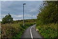
Newcastle-Under-Lyme : Footpath
A footpath heading out from Newcastle-Under-Lyme.
Image: © Lewis Clarke
Taken: 22 Sep 2019
0.20 miles
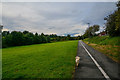
7
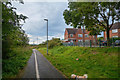
Newcastle-Under-Lyme : Footpath
Looking along a footpath.
Image: © Lewis Clarke
Taken: 22 Sep 2019
0.21 miles
8
Newcastle-Under-Lyme : Footpath
Looking along a footpath.
Image: © Lewis Clarke
Taken: 22 Sep 2019
0.21 miles
9
Milehouse Primary Care Centre car park
Image: © Jonathan Hutchins
Taken: 5 Jun 2015
0.21 miles
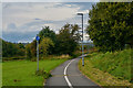
10
Newcastle-Under-Lyme : Footpath
A footpath through the field.
Image: © Lewis Clarke
Taken: 22 Sep 2019
0.22 miles