IMAGES TAKEN NEAR TO
Clews Walk, NEWCASTLE, ST5 8RG

Introduction

This page details the photographs taken nearby to Clews Walk, ST5 8RG by members of the Geograph project.

The Geograph project started in 2005 with the aim of publishing, organising and preserving representative images for every square kilometre of Great Britain, Ireland and the Isle of Man.

There are currently over 7.5m images from over14,400 individuals and you can help contribute to the project by visiting https://www.geograph.org.uk

Image Map


Images are licensed for reuse under creativecommons.org/licenses/by-sa/2.0
Notes
  • Clicking on the map will re-center to the selected point.
  • The higher the marker number, the further away the image location is from the centre of the postcode.

Image Listing (46 Images Found)

Images are licensed for reuse under creativecommons.org/licenses/by-sa/2.0
  • ...
Image
Details
Distance
1
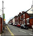
Silverdale Road, Wolstanton
A straight red brick terrace beside a curving road, the B5368, a little west of the High Street.
Image: © Derek Harper Taken: 30 Jun 2006
0.09 miles
2
Wolstanton High Street
Looking north-west along High Street, from the junction with Ellison Street.
Image: © David Weston Taken: 6 May 2018
0.11 miles
3
Village Tavern
On the corner of Lily Street
Image: © Clive Woolliscroft Taken: 19 Jun 2006
0.11 miles
4
St Margaret's Junior School, Wolstanton
Opposite the church, this building of 1871 by James Brooks is Grade II listed, see https://historicengland.org.uk/listing/the-list/list-entry/1219720 Pevsner is enthusiastic, describing it as: 'an outstandingly original design, with the even rhythm of small two-light casement windows divided by a detached shaft with shaft-ring..' (The Buildings of England: Staffordshire (Penguin, 1974))
Image: © Jonathan Hutchins Taken: 21 Jan 2023
0.11 miles
5
Wolstanton High Street
On the other side of the street is the facade with a Venetian window mentioned in Image Pattens, the furniture store, occupies several different premises here.
Image: © Derek Harper Taken: 30 Jun 2006
0.11 miles
6
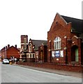
St. Margaret's Junior School, Wolstanton
St Margaret's C E Junior School dates from 1871. This facade on Knutton Road boasts 10 bays; that facing the High Street (right) has 7. http://www.britishlistedbuildings.co.uk/en-385948-school-newcastle-under-lyme
Image: © Derek Harper Taken: 30 Jun 2006
0.11 miles
7
High Street, Wolstanton
Looking in the other direction along Image, with shops on the southwest side between Silverdale Road and Peel Street. The furniture shop beyond occupies a building with a Venetian window, a frequent decorative effect in industrial buildings in the Potteries.
Image: © Derek Harper Taken: 30 Jun 2006
0.11 miles
8
Lily Street Wolstanton
Image: © Clive Woolliscroft Taken: 19 Jun 2006
0.12 miles
9
St Margaret's Junior School, Wolstanton
The building is on the corner of High Street and Knutton Road.
Image: © David Weston Taken: 6 May 2018
0.12 miles
10
Wolstanton Methodist Church
Image: © Clive Woolliscroft Taken: 19 Jun 2006
0.12 miles
  • ...