
IMAGES TAKEN NEAR TO
Earl Street, NEWCASTLE, ST5 6NF
Introduction
This page details the photographs taken nearby to Earl Street, ST5 6NF by members of the Geograph project.
The Geograph project started in 2005 with the aim of publishing, organising and preserving representative images for every square kilometre of Great Britain, Ireland and the Isle of Man.

There are currently over 7.5m images from over14,400 individuals and you can help contribute to the project by visiting https://www.geograph.org.uk
Image Map
Images are licensed for reuse under creativecommons.org/licenses/by-sa/2.0
Notes
- Clicking on the map will re-center to the selected point.
- The higher the marker number, the further away the image location is from the centre of the postcode.
Image Listing (24 Images Found)
Images are licensed for reuse under creativecommons.org/licenses/by-sa/2.0
Image
Details
Distance
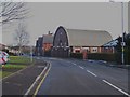
2
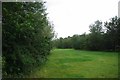
Race Course Community Woodland
An open space in Silverdale sponsored by the Forestry Commission, and the Local Council. However I have been unable to Google up a link for more info.
Image: © Glyn Baker
Taken: 4 Sep 2011
0.11 miles
3
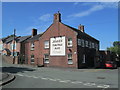
The Crown Inn, Silverdale
Viewed from Albert Street, at the junction with Crown Street.
Image: © David Weston
Taken: 7 Aug 2018
0.12 miles
4
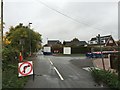
Silverdale: junction of Park Road and Race Course
Image: © Jonathan Hutchins
Taken: 24 Oct 2015
0.15 miles
5
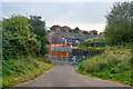
Silverdale : Footpath
A footpath heading down to Crown Street.
Image: © Lewis Clarke
Taken: 22 Sep 2019
0.16 miles
6
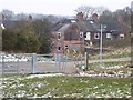
Path and National Cycle Route at Silverdale
Image: © Jonathan Hutchins
Taken: 3 Mar 2018
0.16 miles
7
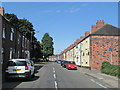
Church Street, Silverdale
Looking west. A small park is left of the street in the middle distance.
Image: © David Weston
Taken: 7 Aug 2018
0.16 miles
8
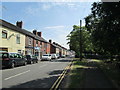
Church Street, Silverdale
Looking east along Church Street. A small park is on the right.
Image: © David Weston
Taken: 7 Aug 2018
0.16 miles
9

Silverdale : Footpath
A footpath along the former Stoke-Market Drayton Line.
Image: © Lewis Clarke
Taken: 22 Sep 2019
0.17 miles
10
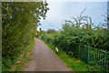
Silverdale : Footpath
A footpath along the former Stoke-Market Drayton Line.
Image: © Lewis Clarke
Taken: 22 Sep 2019
0.17 miles