
IMAGES TAKEN NEAR TO
High Street, NEWCASTLE, ST5 6LX
Introduction
This page details the photographs taken nearby to High Street, ST5 6LX by members of the Geograph project.
The Geograph project started in 2005 with the aim of publishing, organising and preserving representative images for every square kilometre of Great Britain, Ireland and the Isle of Man.

There are currently over 7.5m images from over14,400 individuals and you can help contribute to the project by visiting https://www.geograph.org.uk
Image Map
Images are licensed for reuse under creativecommons.org/licenses/by-sa/2.0
Notes
- Clicking on the map will re-center to the selected point.
- The higher the marker number, the further away the image location is from the centre of the postcode.
Image Listing (38 Images Found)
Images are licensed for reuse under creativecommons.org/licenses/by-sa/2.0
Image
Details
Distance
3
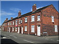
Houses on High Street, Silverdale
The junction with Madeley Street is on the right. Note that there is a bootscraper by each door.
Image: © David Weston
Taken: 7 Aug 2018
0.08 miles
4
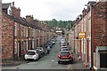
Kinsey St, Silverdale
A Victorian Street in Silverdale
Image: © Glyn Baker
Taken: 4 Sep 2011
0.15 miles
5
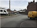
Junction of Vale and Kinsey Streets, Silverdale
Image: © Jonathan Hutchins
Taken: 6 Apr 2018
0.16 miles
6
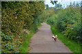
Silverdale : Footpath
A footpath along the former Stoke-Market Drayton Line.
Image: © Lewis Clarke
Taken: 22 Sep 2019
0.17 miles
7
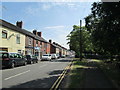
Church Street, Silverdale
Looking east along Church Street. A small park is on the right.
Image: © David Weston
Taken: 7 Aug 2018
0.17 miles
8
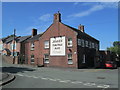
The Crown Inn, Silverdale
Viewed from Albert Street, at the junction with Crown Street.
Image: © David Weston
Taken: 7 Aug 2018
0.17 miles
9
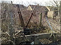
Ground frame alongside disused railway trackbed at Silverdale
As remarkable as the survival, eleven years after the last coal train, of the nearby semaphore signal, is the continued existence of this ground frame.
Image: © Jonathan Hutchins
Taken: 5 Apr 2009
0.17 miles
10
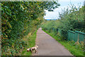
Silverdale : Footpath
A footpath along the former Stoke-Market Drayton Line.
Image: © Lewis Clarke
Taken: 22 Sep 2019
0.18 miles