
IMAGES TAKEN NEAR TO
Woodburn, NEWCASTLE, ST5 6AL
Introduction
This page details the photographs taken nearby to Woodburn, ST5 6AL by members of the Geograph project.
The Geograph project started in 2005 with the aim of publishing, organising and preserving representative images for every square kilometre of Great Britain, Ireland and the Isle of Man.

There are currently over 7.5m images from over14,400 individuals and you can help contribute to the project by visiting https://www.geograph.org.uk
Image Map
Images are licensed for reuse under creativecommons.org/licenses/by-sa/2.0
Notes
- Clicking on the map will re-center to the selected point.
- The higher the marker number, the further away the image location is from the centre of the postcode.
Image Listing (21 Images Found)
Images are licensed for reuse under creativecommons.org/licenses/by-sa/2.0
Image
Details
Distance
1
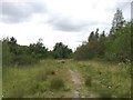
Bateswood SWT Reserve: track round perimeter of plateau
Image: © Jonathan Hutchins
Taken: 4 Aug 2015
0.07 miles
2
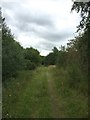
Bateswood SWT Reserve: track round perimeter of plateau
Image: © Jonathan Hutchins
Taken: 4 Aug 2015
0.09 miles
3
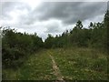
Bateswood SWT Reserve: track round perimeter of plateau
Image: © Jonathan Hutchins
Taken: 4 Aug 2015
0.09 miles
4
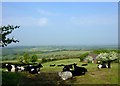
Bateswood former opencast coal site
Looking across to an area now called The Plateau on the restored opencast from behind Scot Hay Cricket Club pavilion. During opencasting the soil was stored in bunds. It was sorted into three types - top soil and soil making material which were used for the agricultural restoration and 'callow'or 'bluebind' which was a heavy subsoil that was only left exposed if there was not enough better quality material to go round. Bateswood was such a site as parts of it had been heavily worked over already. The Plateau was made up from the surplus callow and left to become a wildlife area. It is now a reserve managed by Staffordshire Wildlife Trust.
See also Image
Image
Image and
Image
Image: © Simon Huguet
Taken: 22 May 2008
0.11 miles
5
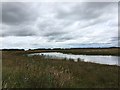
Bateswood SWT Reserve: pool on the plateau
One of two pools on the plateau of this former open-cast coal mining site.
Image: © Jonathan Hutchins
Taken: 4 Aug 2015
0.12 miles
6
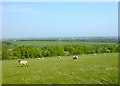
Bateswood Opencast site
Looking from near Scot Hay across the restored coal workings. See also Image for how it looked 25 years ago in 1983.
Image: © Simon Huguet
Taken: 22 May 2008
0.12 miles
7
Bateswood SWT Reserve: track round perimeter of plateau
Image: © Jonathan Hutchins
Taken: 4 Aug 2015
0.13 miles
8
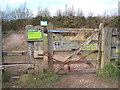
Entrance to Bateswood Nature Reserve
Entrance to the Staffordshire Wildlife Trust's Bateswood reserve between Scot Hay village and the M6.
Image: © Jonathan Hutchins
Taken: 12 Mar 2011
0.17 miles
9
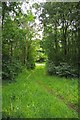
Footpath From Scot Hay
Here the path passes runs through a stand of secondary woodland
Image: © Glyn Baker
Taken: 31 Aug 2012
0.17 miles
10
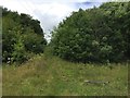
Bateswood SWT Reserve: steps up to the plateau
Image: © Jonathan Hutchins
Taken: 4 Aug 2015
0.18 miles