
IMAGES TAKEN NEAR TO
Cressing Place, NEWCASTLE, ST5 5FJ
Introduction
This page details the photographs taken nearby to Cressing Place, ST5 5FJ by members of the Geograph project.
The Geograph project started in 2005 with the aim of publishing, organising and preserving representative images for every square kilometre of Great Britain, Ireland and the Isle of Man.

There are currently over 7.5m images from over14,400 individuals and you can help contribute to the project by visiting https://www.geograph.org.uk
Image Map
Images are licensed for reuse under creativecommons.org/licenses/by-sa/2.0
Notes
- Clicking on the map will re-center to the selected point.
- The higher the marker number, the further away the image location is from the centre of the postcode.
Image Listing (36 Images Found)
Images are licensed for reuse under creativecommons.org/licenses/by-sa/2.0
Image
Details
Distance
1
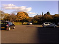
Keele Management Centre car park in the evening sun
The reason this shot was taken in the evening sun is that I had broken down for the third time this week, and was waiting for the rescue services to tow me home. You'll notice that two of the few cars still remaining are Renault Clios, as is mine - perhaps they have broken down too!
Image: © Mari Buckley
Taken: 20 Oct 2010
0.02 miles
2
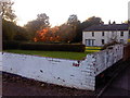
Ugly brick wall
The remains of some building or other spoil the view across the garden to a lovely old house in the grounds of Keele Management Centre. The evening sun cast a beautiful orange glow through the small wood which surrounds the main building.
Image: © Mari Buckley
Taken: 20 Oct 2010
0.03 miles
3
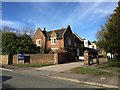
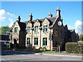
Keele Management Centre
Situated in the village but part of the University, Keele Management Centre offers accommodation and conference facilities.
Image: © Jonathan Hutchins
Taken: 6 Mar 2015
0.08 miles
4

View from Hawthorns H block
Hawthorns is a collection of buildings located on its own site close to the village of Keele and about 20 minutes walk from the main campus of Keele University. It provides accommodation for approx 600 students and its various buildings span 4 decades from the 1950's - 1980's.
Central to the complex is the Templar Bar, named after the Templar Knights to whom Keele was given by Henry 2nd in 1060.
The image was taken from H block, looking across Hawthorns with Keele Church on the skyline.
Image: © Roy Prescott
Taken: 25 Sep 2010
0.08 miles
5
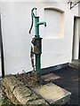
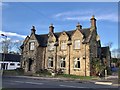
Keele: village pump outside the Sneyd Arms
Image: © Jonathan Hutchins
Taken: 4 Feb 2017
0.09 miles
6
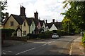
The Village, Keele
This is "The Village" looking towards Station Rd in Keele
Image: © Glyn Baker
Taken: 2 Sep 2011
0.09 miles
9
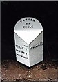
Old Milepost by the former A525, Station Road, Keele Parish
Cast iron post by the A525, in parish of KEELE (NEWCASTLE UNDER LYME District), Station Road, Keele village, West of centre, on the verge in front of drystone wall and hedge, on South West side of road. Dudley iron casting, erected by the Newcastle under Lyme & Nantwich turnpike trust in the 19th century.
Inscription reads:-
: MILES / BETLEY 5 / BASFORD 9 / NANTWICH 12½ : : PARISH / OF / KEELE : : MILES / NEWCASTLE 3 :
Grade II listed
List Entry Number: 1205511 https://historicengland.org.uk/listing/the-list/list-entry/1205511
Milestone Society National ID: ST_NCNW03.
Image: © J Higgins
Taken: 1 Jan 2001
0.10 miles
10
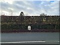
Milepost, Keele
Grade II Listed.
Milepost. Probably late C19. Cast iron with black painted base and lettering. Triangular in section with chamfered top, sloping to front, and semi-circular back-plate. Lettered "PARISH/OF/KEELE" on back-plate; "MILES/BETLEY 5/BASFORD 8/NANTWICH 12½" on left; "MILES/NEWCASTLE 3" on right.
https://historicengland.org.uk/listing/the-list/list-entry/1205511?section=official-list-entry
Image: © Brian Deegan
Taken: 29 Dec 2022
0.11 miles