IMAGES TAKEN NEAR TO
Kendal Place, NEWCASTLE, ST5 3QT
Introduction
This page details the photographs taken nearby to Kendal Place, ST5 3QT by members of the Geograph project.
The Geograph project started in 2005 with the aim of publishing, organising and preserving representative images for every square kilometre of Great Britain, Ireland and the Isle of Man.

There are currently over 7.5m images from over14,400 individuals and you can help contribute to the project by visiting https://www.geograph.org.uk
Image Map (Loading...)


Getting Data...Please wait
Leaflet Map data © OpenStreetMap
Images are licensed for reuse under creativecommons.org/licenses/by-sa/2.0
Notes
- Clicking on the map will re-center to the selected point.
- The higher the marker number, the further away the image location is from the centre of the postcode.
Image Listing (25 Images Found)
Images are licensed for reuse under creativecommons.org/licenses/by-sa/2.0
Image
Details
Distance
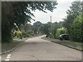
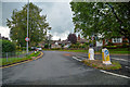
3
Junction of The Plaisaunce and Eleanor Crescent
Image: © Jonathan Hutchins
Taken: 8 Jun 2018
0.13 miles
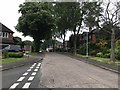
5
Newcastle-Under-Lyme : Abbots Way
Looking along Abbots Way off Clayton Road.
Image: © Lewis Clarke
Taken: 22 Sep 2019
0.18 miles
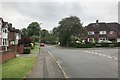
6
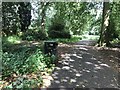
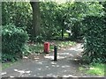
The Parkway, the Westlands
The Three Parks is a narrow belt of parkland with trees which borders a public footpath - the Parkway - from Whitmore Road in the Westlands to Clayton Road. The designation 'Three' is because the park is crossed by Friars' Walk and Abbot's Way, which divides it into three.
Image: © Jonathan Hutchins
Taken: 14 Jun 2018
0.19 miles
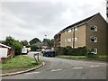
7
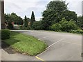
Car park of St Andrew's Church, Westlands
Image: © Jonathan Hutchins
Taken: 4 Jun 2018
0.19 miles
8
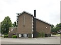
St Andrew's Church, the Westlands
Taken from the church car park. The church was consecrated in 1962.
Image: © Jonathan Hutchins
Taken: 8 Jun 2018
0.20 miles
9
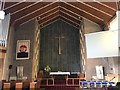
St Andrew's Church, Westlands (interior)
The east end.
Image: © Jonathan Hutchins
Taken: 4 Jun 2018
0.20 miles
10
The Parkway, the Westlands
The Three Parks is a narrow belt of parkland with trees which borders a public footpath - the Parkway - from Whitmore Road in the Westlands to Clayton Road. The designation 'Three' is because the park is crossed by Friars' Walk and Abbot's Way, which divides it into three.
Image: © Jonathan Hutchins
Taken: 14 Jun 2018
0.20 miles