IMAGES TAKEN NEAR TO
Langdale Road, NEWCASTLE, ST5 3QE
Introduction
This page details the photographs taken nearby to Langdale Road, ST5 3QE by members of the Geograph project.
The Geograph project started in 2005 with the aim of publishing, organising and preserving representative images for every square kilometre of Great Britain, Ireland and the Isle of Man.

There are currently over 7.5m images from over14,400 individuals and you can help contribute to the project by visiting https://www.geograph.org.uk
Image Map (Loading...)


Getting Data...Please wait
Leaflet Map data © OpenStreetMap
Images are licensed for reuse under creativecommons.org/licenses/by-sa/2.0
Notes
- Clicking on the map will re-center to the selected point.
- The higher the marker number, the further away the image location is from the centre of the postcode.
Image Listing (9 Images Found)
Images are licensed for reuse under creativecommons.org/licenses/by-sa/2.0
Image
Details
Distance
1
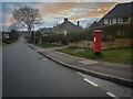
King George V Post Box, Westlands
Post boxes in the United Kingdom bearing the Royal Cypher of King George V, who reigned for 26 years from 6 May 1910 to 20 January 1936.
Image: © Brian Deegan
Taken: 29 Mar 2020
0.15 miles
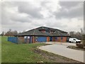
2
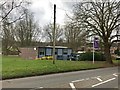
Newcastle-under-Lyme: Clayton Library
Image: © Jonathan Hutchins
Taken: 11 Mar 2017
0.18 miles
3
Newcastle-under-Lyme: Clayton Library
Image: © Jonathan Hutchins
Taken: 11 Mar 2017
0.18 miles
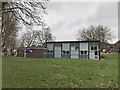
4
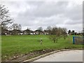
Newcastle-under-Lyme: green space in Clayton
Between the Library and Hollowood Chemist's.
Image: © Jonathan Hutchins
Taken: 11 Mar 2017
0.21 miles
5
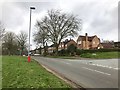
Newcastle-under-Lyme: Dartmouth Avenue
Image: © Jonathan Hutchins
Taken: 11 Mar 2017
0.21 miles
6
Newcastle-Under-Lyme : Dartmouth Avenue
Looking along Dartmouth Avenue off Clayton Road.
Image: © Lewis Clarke
Taken: 22 Sep 2019
0.23 miles
7
Newcastle-under-Lyme: Hollowood Chemist
Image: © Jonathan Hutchins
Taken: 11 Mar 2017
0.23 miles
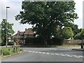
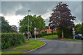
8
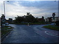
Dartmouth Avenue at Clayton Road roundabout
Image: © Colin Pyle
Taken: 23 Oct 2010
0.24 miles