
IMAGES TAKEN NEAR TO
Dulverton Avenue, NEWCASTLE, ST5 3NF
Introduction
This page details the photographs taken nearby to Dulverton Avenue, ST5 3NF by members of the Geograph project.
The Geograph project started in 2005 with the aim of publishing, organising and preserving representative images for every square kilometre of Great Britain, Ireland and the Isle of Man.

There are currently over 7.5m images from over14,400 individuals and you can help contribute to the project by visiting https://www.geograph.org.uk
Image Map
Images are licensed for reuse under creativecommons.org/licenses/by-sa/2.0
Notes
- Clicking on the map will re-center to the selected point.
- The higher the marker number, the further away the image location is from the centre of the postcode.
Image Listing (6 Images Found)
Images are licensed for reuse under creativecommons.org/licenses/by-sa/2.0
Image
Details
Distance
1
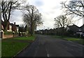
Newcastle-under-Lyme: Sutherland Drive
Image: © Jonathan Hutchins
Taken: 7 Dec 2015
0.18 miles
2
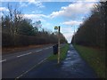
Newcastle-under-Lyme: bus stop on Whitmore Road
Image: © Jonathan Hutchins
Taken: 7 Dec 2015
0.20 miles
3
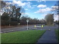
Newcastle-under-Lyme: junction of Sutherland Drive and Whitmore Road
Behind the tall hedge to the left on the north side of Whitmore Road lies Newcastle Golf Club.
Image: © Jonathan Hutchins
Taken: 7 Dec 2015
0.22 miles
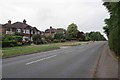
5
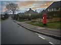
King George V Post Box, Westlands
Post boxes in the United Kingdom bearing the Royal Cypher of King George V, who reigned for 26 years from 6 May 1910 to 20 January 1936.
Image: © Brian Deegan
Taken: 29 Mar 2020
0.23 miles
6
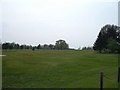
Newcastle Golf Club
View across the golf course from just in front of the clubhouse.
Image: © Steve Lewin
Taken: 21 Apr 2007
0.25 miles