IMAGES TAKEN NEAR TO
Clayton Lane, NEWCASTLE, ST5 3DS
Introduction
This page details the photographs taken nearby to Clayton Lane, ST5 3DS by members of the Geograph project.
The Geograph project started in 2005 with the aim of publishing, organising and preserving representative images for every square kilometre of Great Britain, Ireland and the Isle of Man.

There are currently over 7.5m images from over14,400 individuals and you can help contribute to the project by visiting https://www.geograph.org.uk
Image Map
Images are licensed for reuse under creativecommons.org/licenses/by-sa/2.0
Notes
- Clicking on the map will re-center to the selected point.
- The higher the marker number, the further away the image location is from the centre of the postcode.
Image Listing (18 Images Found)
Images are licensed for reuse under creativecommons.org/licenses/by-sa/2.0
Image
Details
Distance
1
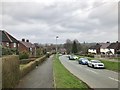
Newcastle-under-Lyme: Wiltshire Grove
Image: © Jonathan Hutchins
Taken: 11 Mar 2017
0.04 miles
2
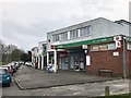
Newcastle-under-Lyme: Cambridge Court
Image: © Jonathan Hutchins
Taken: 11 Mar 2017
0.09 miles
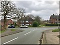
4
Newcastle-under-Lyme: Lilleshall Road at its junction with Stafford Avenue
Image: © Jonathan Hutchins
Taken: 11 Mar 2017
0.14 miles
5
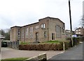
Newcastle-under-Lyme Baptist Church
This church has replaced http://www.geograph.org.uk/photo/4317338 as the Baptist Church of Newcastle.
Image: © Jonathan Hutchins
Taken: 11 Mar 2017
0.15 miles
6
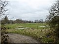
Newcastle-under-Lyme: Lyme valley
Image: © Jonathan Hutchins
Taken: 11 Mar 2017
0.16 miles
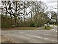
7
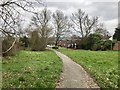
Newcastle-under-Lyme: path between Stafford Crescent and Wiltshire Grove
Image: © Jonathan Hutchins
Taken: 11 Mar 2017
0.16 miles
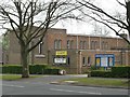
8
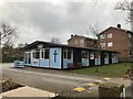
Newcastle-under-Lyme Baptist church hall
Image: © Jonathan Hutchins
Taken: 11 Mar 2017
0.17 miles
9

Newcastle-under-Lyme Baptist church noticeboard
Image: © Jonathan Hutchins
Taken: 11 Mar 2017
0.17 miles
10
Newcastle-under-Lyme: junction of Warwick Avenue and Stafford Crescent
Image: © Jonathan Hutchins
Taken: 11 Mar 2017
0.19 miles