
IMAGES TAKEN NEAR TO
Clayton Road, NEWCASTLE, ST5 3AQ
Introduction
This page details the photographs taken nearby to Clayton Road, ST5 3AQ by members of the Geograph project.
The Geograph project started in 2005 with the aim of publishing, organising and preserving representative images for every square kilometre of Great Britain, Ireland and the Isle of Man.

There are currently over 7.5m images from over14,400 individuals and you can help contribute to the project by visiting https://www.geograph.org.uk
Image Map
Images are licensed for reuse under creativecommons.org/licenses/by-sa/2.0
Notes
- Clicking on the map will re-center to the selected point.
- The higher the marker number, the further away the image location is from the centre of the postcode.
Image Listing (122 Images Found)
Images are licensed for reuse under creativecommons.org/licenses/by-sa/2.0
Image
Details
Distance
2
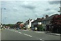
Newcastle-under-Lyme: Clayton Road
Image: © Jonathan Hutchins
Taken: 16 Jun 2015
0.05 miles
3
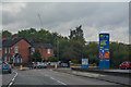
Newcastle-Under-Lyme : Clayton Road A519
Looking along Clayton Road.
Image: © Lewis Clarke
Taken: 22 Sep 2019
0.05 miles
4
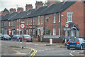
Newcastle-Under-Lyme : Brook Lane B5043
Friarswood Road off Brook Lane.
Image: © Lewis Clarke
Taken: 22 Sep 2019
0.06 miles
5
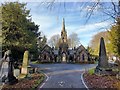
Newcastle Under Lyme Cemetery Chapel
Cemetery Chapels. 1866. By Bellamy and Hardy. Rusticated coursed and squared rubble with slate roofs with scalloped bands and ridge cresting. Symmetrical design with two chapels, one each of central entrance arcade surmounted by tower. Central tower over ogee archway with angle buttresses and crocketted pinnacles then brooch spire. Side arches sprung from corbels link to chapels, entered from within the arcade. Each chapel has 2-light Decorated windows to NW, beneath pinnacled gable. 3 windows in side walls, the higher central window contained in advanced coped gable, and canted SE end with Decorated windows and octagonal chimneys.
https://historicengland.org.uk/listing/the-list/list-entry/1291319
Image: © Brian Deegan
Taken: 18 Jan 2020
0.07 miles
6

Homebase, Newcastle under Lyme
Brook Lane is just off left hand edge of photo. ST5 3HU
Image: © Carl Farnell
Taken: 16 Jun 2011
0.07 miles
7
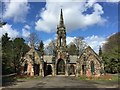
Newcastle-under-Lyme cemetery chapels
Grade II listed building of 1866 by Bellamy & Hardy. More details at http://list.historicengland.org.uk/resultsingle.aspx?uid=1291319.
Image: © Jonathan Hutchins
Taken: 11 Apr 2015
0.07 miles
8
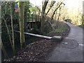
Lyme Valley Park: footpath and pipe over the Lyme Brook
Image: © Jonathan Hutchins
Taken: 8 Jan 2015
0.07 miles
9
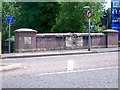
Road bridge over Lyme Brook, Newcastle under Lyme
This is the south eastern side of the bridge on Brook Lane, (B5043)
The parapet sculpture is dated 1995, by Ian Randall. It was commissioned to commemorate the completion of flood prevention works in 2000.
Image: © Carl Farnell
Taken: 16 Jun 2011
0.08 miles
10
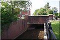
The Lyme Brook Newcastle
This is the stream that gives this town its name.
Image: © Glyn Baker
Taken: 19 Jul 2013
0.08 miles