IMAGES TAKEN NEAR TO
St. Andrews Drive, NEWCASTLE, ST5 2NW
Introduction
This page details the photographs taken nearby to St. Andrews Drive, ST5 2NW by members of the Geograph project.
The Geograph project started in 2005 with the aim of publishing, organising and preserving representative images for every square kilometre of Great Britain, Ireland and the Isle of Man.

There are currently over 7.5m images from over14,400 individuals and you can help contribute to the project by visiting https://www.geograph.org.uk
Image Map (40 Images)


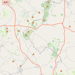

Leaflet Map data © OpenStreetMap
Images are licensed for reuse under creativecommons.org/licenses/by-sa/2.0
Notes
- Clicking on the map will re-center to the selected point.
- The higher the marker number, the further away the image location is from the centre of the postcode.
Image Listing (40 Images Found)
Images are licensed for reuse under creativecommons.org/licenses/by-sa/2.0
Image
Details
Distance
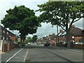
1
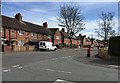
Newcastle-under-Lyme: junction of Orme Road and Poolfield Avenue
Image: © Jonathan Hutchins
Taken: 15 Apr 2015
0.07 miles
2
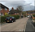
Newcastle-under-Lyme: St Mary's Drive, Poolfields
Image: © Jonathan Hutchins
Taken: 15 Apr 2015
0.10 miles
3
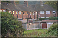
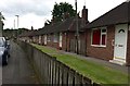
Newcastle-Under-Lyme : Houses
Houses backing onto Rotterdam.
Image: © Lewis Clarke
Taken: 22 Sep 2019
0.10 miles
4
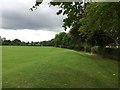
Newcastle-under-Lyme: playing fields off St Paul's Road
Image: © Jonathan Hutchins
Taken: 11 Jul 2015
0.11 miles
5
Newcastle-under-Lyme: stream by St Paul's Road
This is taken from Image
Image: © Jonathan Hutchins
Taken: 11 Jul 2015
0.12 miles
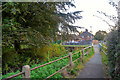
6
Newcastle-under-Lyme: footbridge off St Paul's Road
Image: © Jonathan Hutchins
Taken: 11 Jul 2015
0.13 miles
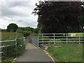
8
Newcastle-Under-Lyme : Footpath
A footpath heading to Rotterdam.
Image: © Lewis Clarke
Taken: 22 Sep 2019
0.14 miles
9
Newcastle-under-Lyme: sheltered housing, St Paul's Road
Image: © Jonathan Hutchins
Taken: 11 Jul 2015
0.14 miles
10
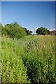
A Drainage Ditch
A wildlife haven in the flood plain of the Lyme Brook
Image: © Glyn Baker
Taken: 19 Jul 2013
0.14 miles