IMAGES TAKEN NEAR TO
Thistleberry Avenue, NEWCASTLE, ST5 2LT
Introduction
This page details the photographs taken nearby to Thistleberry Avenue, ST5 2LT by members of the Geograph project.
The Geograph project started in 2005 with the aim of publishing, organising and preserving representative images for every square kilometre of Great Britain, Ireland and the Isle of Man.

There are currently over 7.5m images from over14,400 individuals and you can help contribute to the project by visiting https://www.geograph.org.uk
Image Map
Images are licensed for reuse under creativecommons.org/licenses/by-sa/2.0
Notes
- Clicking on the map will re-center to the selected point.
- The higher the marker number, the further away the image location is from the centre of the postcode.
Image Listing (33 Images Found)
Images are licensed for reuse under creativecommons.org/licenses/by-sa/2.0
Image
Details
Distance
1
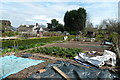
Newcastle-under-Lyme: Thistleberry Allotments
Image: © Jonathan Hutchins
Taken: 15 Apr 2015
0.03 miles
2
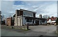
Newcastle-under-Lyme: Thistleberry Hotel
The nameboard says 'The Thistleberry' but it is referred to on its own website (and the sign on the adjacent bus stop) by the term 'hotel', though it does not offer accommodation.
Image: © Jonathan Hutchins
Taken: 15 Apr 2015
0.07 miles
3
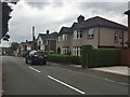
Newcastle-under-Lyme: Emery Avenue
Image: © Jonathan Hutchins
Taken: 8 Apr 2015
0.08 miles
4
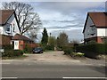
Newcastle-under-Lyme: private lane off Keele Road
Image: © Jonathan Hutchins
Taken: 15 Apr 2015
0.08 miles
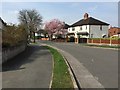
5
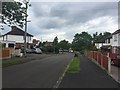
Newcastle-under-Lyme: Whitfield Avenue
Image: © Jonathan Hutchins
Taken: 26 Jun 2015
0.08 miles
6
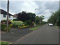
Newcastle-under-Lyme: Whitfield Avenue (west side)
Image: © Jonathan Hutchins
Taken: 26 Jun 2015
0.09 miles
7
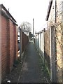
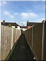
Newcastle-under-Lyme: alley between Emery Avenue and Whitfield Avenue
This short dead straight alleyway is a public footpath with the designation Newcastle 119.
Image: © Jonathan Hutchins
Taken: 8 Apr 2015
0.10 miles
8
Newcastle-under-Lyme: Mayfield Avenue (east side)
Image: © Jonathan Hutchins
Taken: 26 Jun 2015
0.11 miles
9
Newcastle-under-Lyme: alley between Emery Avenue and Whitfield Avenue
This short dead straight alleyway is a public footpath with the designation Newcastle 119.
Image: © Jonathan Hutchins
Taken: 8 Apr 2015
0.11 miles
10
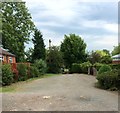
Newcastle-under-Lyme: private lane off Keele Road
A view from further back at the roadside is at http://www.geograph.org.uk/photo/4433525.
Image: © Jonathan Hutchins
Taken: 1 Jul 2015
0.13 miles