
IMAGES TAKEN NEAR TO
Barnacle Place, NEWCASTLE, ST5 2GS
Introduction
This page details the photographs taken nearby to Barnacle Place, ST5 2GS by members of the Geograph project.
The Geograph project started in 2005 with the aim of publishing, organising and preserving representative images for every square kilometre of Great Britain, Ireland and the Isle of Man.

There are currently over 7.5m images from over14,400 individuals and you can help contribute to the project by visiting https://www.geograph.org.uk
Image Map
Images are licensed for reuse under creativecommons.org/licenses/by-sa/2.0
Notes
- Clicking on the map will re-center to the selected point.
- The higher the marker number, the further away the image location is from the centre of the postcode.
Image Listing (9 Images Found)
Images are licensed for reuse under creativecommons.org/licenses/by-sa/2.0
Image
Details
Distance
1

Water Meadow Near Poolfields
A water meadow in the flood plain of the Lyme Brook
Image: © Glyn Baker
Taken: 19 Jul 2013
0.16 miles
2
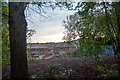
Silverdale : Halfway Place
From the footpath looking to the houses on Halfway Place.
Image: © Lewis Clarke
Taken: 22 Sep 2019
0.22 miles
3

Silverdale : Footpath
A footpath heading to Cherry Hill Lane.
Image: © Lewis Clarke
Taken: 22 Sep 2019
0.23 miles
5
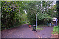
Silverdale : Footpath
A footpath along the former Stoke-Market Drayton Line.
Image: © Lewis Clarke
Taken: 22 Sep 2019
0.24 miles
6
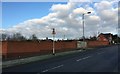
Knutton: site of former pub
A large pub called The Forge Inn was situated on the waste ground behind these neat brick walls, erected soon after its demolition in 2009 http://www.closedpubs.co.uk/staffordshire/newcastleunderlyme_forgeinn.html. Knutton Forge was a huge complex of furnaces and mills, producing large quantities of iron in its heyday, which closed in 1929, leaving only the pub and local memories to perpetuate its name.
Image: © Jonathan Hutchins
Taken: 6 Feb 2015
0.24 miles
7

Silverdale : Industrial Units
Industrial units at Silverdale.
Image: © Lewis Clarke
Taken: 22 Sep 2019
0.24 miles
8
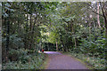
Silverdale : Footpath
A footpath along the former Stoke-Market Drayton Line.
Image: © Lewis Clarke
Taken: 22 Sep 2019
0.24 miles
9
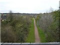
Footpath at Knutton
One of many disused railway tracks in this area now recycled as footpaths.
Image: © Steve Lewin
Taken: 9 Apr 2007
0.24 miles