
IMAGES TAKEN NEAR TO
Barracks Road, NEWCASTLE, ST5 1UP
Introduction
This page details the photographs taken nearby to Barracks Road, ST5 1UP by members of the Geograph project.
The Geograph project started in 2005 with the aim of publishing, organising and preserving representative images for every square kilometre of Great Britain, Ireland and the Isle of Man.

There are currently over 7.5m images from over14,400 individuals and you can help contribute to the project by visiting https://www.geograph.org.uk
Image Map
Images are licensed for reuse under creativecommons.org/licenses/by-sa/2.0
Notes
- Clicking on the map will re-center to the selected point.
- The higher the marker number, the further away the image location is from the centre of the postcode.
Image Listing (415 Images Found)
Images are licensed for reuse under creativecommons.org/licenses/by-sa/2.0
Image
Details
Distance
1
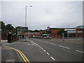
Barracks Road, Newcastle under Lyme
A section of the A527, which forms part of Newcastle's inner ring road. The bus is one of many that use Barracks Road, as the bus station is a short distance behind the photographer.
Image: © Richard Vince
Taken: 29 Jun 2013
0.02 miles
2
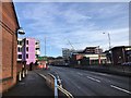
Newcastle-under-Lyme: new developments off Barrack Road
On the left, the new 'public sector hub' (see http://www.geograph.org.uk/photo/5273125 ); on the right the Sky Building, new student accommodation (see http://www.geograph.org.uk/photo/5273102 )
Image: © Jonathan Hutchins
Taken: 4 Feb 2017
0.04 miles
4
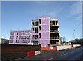
Newcastle-under-Lyme: new public sector hub under construction
The site formerly occupied by the long-closed St Giles' and St George's School (see http://www.geograph.org.uk/photo/4339689 ) was cleared late in 2016 and construction is proceeding apace. This new 'public sector hub' will house Newcastle Borough Council (currently in the Civic Offices on Merrial Street http://www.geograph.org.uk/photo/4339895 ), the local offices of Staffordshire County Council, Newcastle Police and some functions of the Registry Office http://www.geograph.org.uk/photo/5128290
The striking mauve look is the insulation boarding.
Image: © Jonathan Hutchins
Taken: 4 Feb 2017
0.05 miles
5
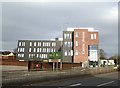
Castle House, Newcastle-under-Lyme (1)
The site formerly occupied by the long-closed St Giles' and St George's School (see http://www.geograph.org.uk/photo/4339689 ) is now home to a new 'public sector hub' which will house Newcastle Borough Council (currently in the Civic Offices on Merrial Street http://www.geograph.org.uk/photo/4339895 ), the local offices of Staffordshire County Council, Newcastle Police, Aspire Housing, and some functions of the Registry Office http://www.geograph.org.uk/photo/5128290
A year previously, Image is taken from close by on Barracks Road.
Image: © Jonathan Hutchins
Taken: 21 Feb 2018
0.05 miles
6
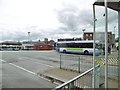
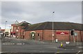
Newcastle-under-Lyme Bus Station
On Stubbs Street.
Image: © Mike Faherty
Taken: 3 Aug 2015
0.05 miles
7
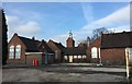
Newcastle-under-Lyme: St Giles and St George?s School (closed)
The school was founded in 1825: these buildings date from 1895. The school closed around 2005 and the site has remained in this condition ever since. The Council’s preference is that it be used for housing.
Image: © Jonathan Hutchins
Taken: 7 Feb 2015
0.05 miles
8
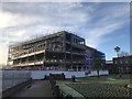
Newcastle-under-Lyme: new public sector hub under construction
The site formerly occupied by the long-closed St Giles' and St George's School (see http://www.geograph.org.uk/photo/4339689 ) was cleared late in 2016 and construction is proceeding apace. This new 'public sector hub' will house Newcastle Borough Council (currently in the Civic Offices on Merrial Street http://www.geograph.org.uk/photo/4339895 ), the local offices of Staffordshire County Council, Newcastle Police and some functions of the Registry Office http://www.geograph.org.uk/photo/5128290
In the foreground are Queen's Gardens (see e.g. http://www.geograph.org.uk/photo/5218425 )
Image: © Jonathan Hutchins
Taken: 4 Feb 2017
0.05 miles
9
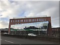
Castle House, Newcastle-under-Lyme (3)
The site formerly occupied by the long-closed St Giles' and St George's School (see http://www.geograph.org.uk/photo/4339689 ) is now home to a new 'public sector hub' which will house Newcastle Borough Council (currently in the Civic Offices on Merrial Street http://www.geograph.org.uk/photo/4339895 ), the local offices of Staffordshire County Council, Newcastle Police, Aspire Housing, and some functions of the Registry Office http://www.geograph.org.uk/photo/5128290
Image: © Jonathan Hutchins
Taken: 21 Feb 2018
0.05 miles
10
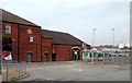
Exit of bus station, Newcastle under Lyne
Image: © Claire MacNeill
Taken: 12 Aug 2012
0.05 miles