IMAGES TAKEN NEAR TO
The Crossway, NEWCASTLE, ST5 0RZ
Introduction
This page details the photographs taken nearby to The Crossway, ST5 0RZ by members of the Geograph project.
The Geograph project started in 2005 with the aim of publishing, organising and preserving representative images for every square kilometre of Great Britain, Ireland and the Isle of Man.

There are currently over 7.5m images from over14,400 individuals and you can help contribute to the project by visiting https://www.geograph.org.uk
Image Map
Images are licensed for reuse under creativecommons.org/licenses/by-sa/2.0
Notes
- Clicking on the map will re-center to the selected point.
- The higher the marker number, the further away the image location is from the centre of the postcode.
Image Listing (18 Images Found)
Images are licensed for reuse under creativecommons.org/licenses/by-sa/2.0
Image
Details
Distance
1
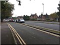
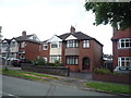
Newcastle-under-Lyme: Wulstan Drive
Image: © Jonathan Hutchins
Taken: 21 Sep 2016
0.15 miles
2
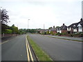
Newcastle-under-Lyme: Marina Drive from Wulstan Drive
Image: © Jonathan Hutchins
Taken: 21 Sep 2016
0.15 miles
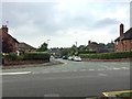
4
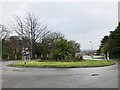
Newcastle-under-Lyme: roundabout on A527
Image: © Jonathan Hutchins
Taken: 11 Feb 2017
0.17 miles
7
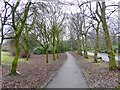
Newcastle-under-Lyme: footpath alongside Brampton Road A527
Image: © Jonathan Hutchins
Taken: 11 Feb 2017
0.19 miles
8
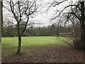
Newcastle-under-Lyme: green space alongside A527 in Brampton
Image: © Jonathan Hutchins
Taken: 11 Feb 2017
0.19 miles
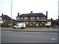
9
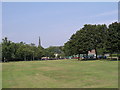
May Bank, Wolstanton Marsh
The Marsh is a large open space between May Bank and Wolstanton, given to the local people a long time ago by the Duchy of Lancaster as a recreational area in perpetuity. A Roman Road, Rykeneld Street, is also documented as crossing The Marsh at Wolstanton. This view taken at SJ856476 with St Margaret's Church in the background.
Image: © Alan Fleming
Taken: 4 Sep 2005
0.20 miles
10
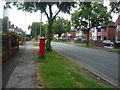
Hempstall Lane
Looking north showing position of Postbox No. ST5 11.
See Image] for postbox.
Image: © JThomas
Taken: 11 Jun 2016
0.20 miles