IMAGES TAKEN NEAR TO
Wulstan Drive, NEWCASTLE, ST5 0RH
Introduction
This page details the photographs taken nearby to Wulstan Drive, ST5 0RH by members of the Geograph project.
The Geograph project started in 2005 with the aim of publishing, organising and preserving representative images for every square kilometre of Great Britain, Ireland and the Isle of Man.

There are currently over 7.5m images from over14,400 individuals and you can help contribute to the project by visiting https://www.geograph.org.uk
Image Map
Images are licensed for reuse under creativecommons.org/licenses/by-sa/2.0
Notes
- Clicking on the map will re-center to the selected point.
- The higher the marker number, the further away the image location is from the centre of the postcode.
Image Listing (34 Images Found)
Images are licensed for reuse under creativecommons.org/licenses/by-sa/2.0
Image
Details
Distance
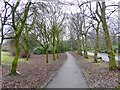
1
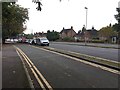
Newcastle-under-Lyme: Wulstan Drive
Image: © Jonathan Hutchins
Taken: 21 Sep 2016
0.02 miles
2
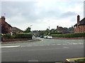
Newcastle-under-Lyme: Marina Drive from Wulstan Drive
Image: © Jonathan Hutchins
Taken: 21 Sep 2016
0.05 miles
3
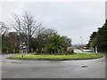
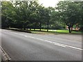
Newcastle-under-Lyme: roundabout on A527
Image: © Jonathan Hutchins
Taken: 11 Feb 2017
0.07 miles
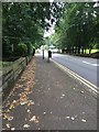
5
Newcastle-under-Lyme: footpath alongside Brampton Road A527
Image: © Jonathan Hutchins
Taken: 11 Feb 2017
0.08 miles
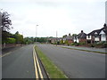
6
Newcastle-under-Lyme: Brampton Road
Image: © Jonathan Hutchins
Taken: 21 Sep 2016
0.09 miles
7
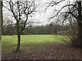
Newcastle-under-Lyme: green space alongside A527 in Brampton
Image: © Jonathan Hutchins
Taken: 11 Feb 2017
0.10 miles
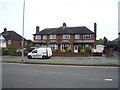
9
Newcastle-under-Lyme: Brampton Road
Image: © Jonathan Hutchins
Taken: 21 Sep 2016
0.13 miles
10
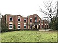
Newcastle-under-Lyme: RBS European Operations Centre
Image: © Jonathan Hutchins
Taken: 11 Feb 2017
0.14 miles