IMAGES TAKEN NEAR TO
Wolstanton Retail Park, NEWCASTLE, ST5 0AP
Introduction
This page details the photographs taken nearby to Wolstanton Retail Park, ST5 0AP by members of the Geograph project.
The Geograph project started in 2005 with the aim of publishing, organising and preserving representative images for every square kilometre of Great Britain, Ireland and the Isle of Man.

There are currently over 7.5m images from over14,400 individuals and you can help contribute to the project by visiting https://www.geograph.org.uk
Image Map
Images are licensed for reuse under creativecommons.org/licenses/by-sa/2.0
Notes
- Clicking on the map will re-center to the selected point.
- The higher the marker number, the further away the image location is from the centre of the postcode.
Image Listing (59 Images Found)
Images are licensed for reuse under creativecommons.org/licenses/by-sa/2.0
Image
Details
Distance

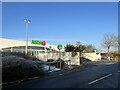
5
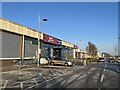
Wolstanton Retail Park: Homebase / Argos
From 2014, Argos opened several concessions in Homebase stores. Both are owned by Home Retail Group.
Image: © Jonathan Hutchins
Taken: 21 Dec 2015
0.06 miles
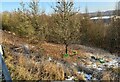
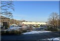
8
Steps from Wolstanton to the Retail Park
Image: © Jonathan Hutchins
Taken: 21 Jan 2023
0.08 miles
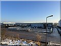
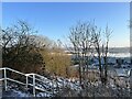
9
Steps from Wolstanton to the Retail Park
Image: © Jonathan Hutchins
Taken: 21 Jan 2023
0.08 miles
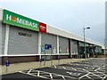
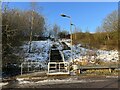
10
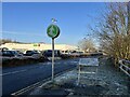
Information board at Wolstanton Retail Park
A close-up of the board is seen in https://www.geograph.org.uk/photo/7387904
Image: © Jonathan Hutchins
Taken: 21 Jan 2023
0.09 miles