1
Housing estate at Pacific Road, Trentham
Image: © Linda Mellor
Taken: 26 Sep 2005
0.15 miles
2
Trent & Mersey Canal Milepost at Trentham
Image, for the previous milepost.
Image, for the next milepost along the canal.
Image: © Mat Fascione
Taken: 11 Jul 2015
0.18 miles
3
Trent & Mersey canal towards bridge #108
Image: © Ian S
Taken: 17 Jan 2022
0.18 miles
4
Old milemarker by the Trent & Mersey Canal, Trentham
Milemarker by the Trent & Mersey Canal, in parish of Stoke on Trent (Stoke on Trent District), North of Longton Road, East of Pacific Road.
Inscription reads:-
: SHARDLOW / 53 / MILES : : PRESTON / BROOK / 39 / MILES :
Maker:-
: R&D / STONE / 1819 :
Grade II listed.
List Entry Number: 1242005 https://historicengland.org.uk/listing/the-list/list-entry/1242005
Surveyed
Milestone Society National ID: TMC-53
Image: © Milestone Society
Taken: Unknown
0.19 miles
5
Typical suburban street scene on The Lea
The street is located very close to Ash Green Primary school, with parents and guardians attempting to park as close as possible, on a street passable by one car in each direction. The white posts on the grass verge are to prevent cars parking on the verges. As can be seen on the building to the left hand side, external plaster rendering has been applied to some properties on the street. The blue bins are for recyclable waste, collected by Stoke on Trent Council every two weeks. Photograph taken at street side path by number 69 The Lea.
Image: © James Goes Social
Taken: 31 Dec 2021
0.19 miles
6
Canalside pasture near Trentham, Stoke-on-Trent
Looking north-north-east. These pastures by the Trent and Mersey Canal were under threat from Barratt Homes development, and notices were posted urging refusal of planning permission.
Image: © Roger Kidd
Taken: 3 Aug 2015
0.19 miles
7
Canal north-east of Trentham, Stoke-on-Trent
Looking north towards Stoke city centre. These pastures by the Trent and Mersey Canal were under threat from Barratt Homes development, and notices were posted urging refusal of planning permission.
Image: © Roger Kidd
Taken: 3 Aug 2015
0.20 miles
8
Trent and Mersey Canal near Trentham, Stoke-on-Trent
This is the Trent and Mersey Canal north-east of Trentham. A winding hole is provided here, which explains the width of the water in the foreground.
Image: © Roger Kidd
Taken: 1 Sep 2009
0.20 miles
9
Trent & Mersey canal towards bridge #108
Image: © Ian S
Taken: 17 Jan 2022
0.21 miles
10
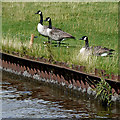
Canada geese near Trentham, Stoke-on-Trent
Grazing by the Trent and Mersey Canal near Newstead Brook.
Image: © Roger Kidd
Taken: 4 Sep 2009
0.21 miles


