IMAGES TAKEN NEAR TO
Lionel Grove, STOKE-ON-TRENT, ST4 6RW
Introduction
This page details the photographs taken nearby to Lionel Grove, ST4 6RW by members of the Geograph project.
The Geograph project started in 2005 with the aim of publishing, organising and preserving representative images for every square kilometre of Great Britain, Ireland and the Isle of Man.

There are currently over 7.5m images from over14,400 individuals and you can help contribute to the project by visiting https://www.geograph.org.uk
Image Map
Images are licensed for reuse under creativecommons.org/licenses/by-sa/2.0
Notes
- Clicking on the map will re-center to the selected point.
- The higher the marker number, the further away the image location is from the centre of the postcode.
Image Listing (96 Images Found)
Images are licensed for reuse under creativecommons.org/licenses/by-sa/2.0
Image
Details
Distance
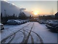
1
Royal Stoke University Hospital: staff car park
Adjacent to doctors' accommodation (see e.g. http://www.geograph.org.uk/photo/5132702 ). The main hospital building is in the background.
Image: © Jonathan Hutchins
Taken: 6 Oct 2016
0.06 miles
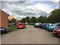
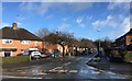
3

Hartshill: pensioners' bungalows
The lane behind the bungalows can be seen here http://www.geograph.org.uk/photo/5129668
Image: © Jonathan Hutchins
Taken: 8 Jul 2015
0.06 miles
4
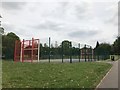
Play area in Hartshill
Behind the multi-purpose sports court are swings, slides and other facilities.
Image: © Jonathan Hutchins
Taken: 18 May 2018
0.07 miles
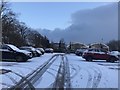
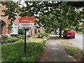
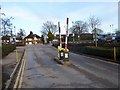
5
Hartshill: Oliver Road from Hilton Road
Image: © Jonathan Hutchins
Taken: 30 Jan 2015
0.08 miles
7
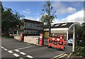
Recently closed ambulance station
The Broomhall Centre on Hilton Road in Stoke-on-Trent closed on 25th May 2017 after 55 years and the service relocated to much larger premises in Etruria just off the A500.
See Image for a view of the site almost wholly demolished in October 2018.
Image: © Jonathan Hutchins
Taken: 15 Jun 2017
0.09 miles
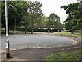
9
Harplands Hospital: barriers on access road
This access road is also a public footpath, which splits into two behind the photographer and encircles the site along the route of the access roads.
Image: © Jonathan Hutchins
Taken: 4 Feb 2017
0.09 miles