1
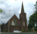
Jubilee Working Mens Club
Image: © Anthony Parkes
Taken: 11 Apr 2014
0.08 miles
2
Trent Vale: St John's Church
Pevsner gives a date of 1909, the architect A.R. Piercy. The south aisle is the former nave of a church of 1843-45.
Image: © Jonathan Hutchins
Taken: 8 Dec 2015
0.13 miles
3
Church of St John the Evangelist, Trent Vale
Erected in 1843, the architect was Philip Wooton
Image: © Neil Lewin
Taken: 11 Aug 2006
0.16 miles
4
Great War Commemorative Cross
outside St John's Church, Trent Vale
Image: © Neil Lewin
Taken: 11 Aug 2006
0.16 miles
5
Stoke-on-Trent: Harpfield Road
Image: © Jonathan Hutchins
Taken: 7 Oct 2016
0.17 miles
6
Reclaimed clay pit, Springfields, Stoke-on-Trent
This landscaped pond, together with the new housing development in the background and the adjacent Springfields Retail Park, were created from a redundant tile-making factory site and associated clay pits.
Image: © Jonathan Hutchins
Taken: 19 Oct 2015
0.19 miles
7
Trent Vale: Brookfield Road
Image: © Jonathan Hutchins
Taken: 11 Mar 2017
0.20 miles
8
Trent Vale: boarded-up house on the corner of Leaside Road and Newcastle Road
Image: © Jonathan Hutchins
Taken: 21 Dec 2014
0.21 miles
9
Squeeze stile off Springfields Retail Park
This provides access to a housing development and landscaped pond. These, together with the Springfields Retail Park itself, were created from a redundant tile-making factory site and associated clay pits.
Image: © Jonathan Hutchins
Taken: 19 Oct 2015
0.22 miles
10
Trent Vale: Leaside Road
The waste ground behind the fence on the left is seen also in http://www.geograph.org.uk/photo/4285743 , but the building in the 2014 photo has since been demolished. Out of view on the right is Tesco and its filling station - http://www.geograph.org.uk/photo/4784312 and http://www.geograph.org.uk/photo/4509758
Image: © Jonathan Hutchins
Taken: 11 Mar 2017
0.22 miles


