IMAGES TAKEN NEAR TO
Littlefield, STOKE-ON-TRENT, ST4 5LR
Introduction
This page details the photographs taken nearby to Littlefield, ST4 5LR by members of the Geograph project.
The Geograph project started in 2005 with the aim of publishing, organising and preserving representative images for every square kilometre of Great Britain, Ireland and the Isle of Man.

There are currently over 7.5m images from over14,400 individuals and you can help contribute to the project by visiting https://www.geograph.org.uk
Image Map
Images are licensed for reuse under creativecommons.org/licenses/by-sa/2.0
Notes
- Clicking on the map will re-center to the selected point.
- The higher the marker number, the further away the image location is from the centre of the postcode.
Image Listing (16 Images Found)
Images are licensed for reuse under creativecommons.org/licenses/by-sa/2.0
Image
Details
Distance
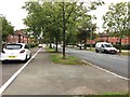
3
Reclaimed clay pit, Springfields, Stoke-on-Trent
This landscaped pond, together with the new housing development in the background and the adjacent Springfields Retail Park, were created from a redundant tile-making factory site and associated clay pits.
Image: © Jonathan Hutchins
Taken: 19 Oct 2015
0.14 miles
4
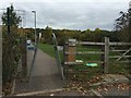
Squeeze stile off Springfields Retail Park
This provides access to a housing development and landscaped pond. These, together with the Springfields Retail Park itself, were created from a redundant tile-making factory site and associated clay pits.
Image: © Jonathan Hutchins
Taken: 19 Oct 2015
0.18 miles
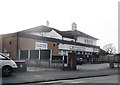
5
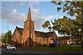
Trent Vale: St John's Church
Pevsner gives a date of 1909, the architect A.R. Piercy. The south aisle is the former nave of a church of 1843-45.
Image: © Jonathan Hutchins
Taken: 8 Dec 2015
0.18 miles
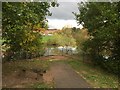
6
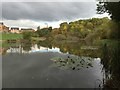
Reclaimed clay pit, Springfields, Stoke-on-Trent
This landscaped pond, together with the new housing development in the background and the adjacent Springfields Retail Park, were created from a redundant tile-making factory site and associated clay pits.
Image: © Jonathan Hutchins
Taken: 19 Oct 2015
0.19 miles
7
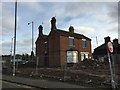
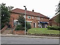
Trent Vale: boarded-up house on the corner of Leaside Road and Newcastle Road
Image: © Jonathan Hutchins
Taken: 21 Dec 2014
0.19 miles
9
Stoke-on-Trent: shops off Harpfield Road
Image: © Jonathan Hutchins
Taken: 7 Oct 2016
0.20 miles
10
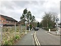
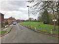
Trent Vale: Leaside Road
The waste ground behind the fence on the left is seen also in http://www.geograph.org.uk/photo/4285743 , but the building in the 2014 photo has since been demolished. Out of view on the right is Tesco and its filling station - http://www.geograph.org.uk/photo/4784312 and http://www.geograph.org.uk/photo/4509758
Image: © Jonathan Hutchins
Taken: 11 Mar 2017
0.21 miles