
IMAGES TAKEN NEAR TO
Alfred Street, STOKE-ON-TRENT, ST4 2HH
Introduction
This page details the photographs taken nearby to Alfred Street, ST4 2HH by members of the Geograph project.
The Geograph project started in 2005 with the aim of publishing, organising and preserving representative images for every square kilometre of Great Britain, Ireland and the Isle of Man.

There are currently over 7.5m images from over14,400 individuals and you can help contribute to the project by visiting https://www.geograph.org.uk
Image Map
Images are licensed for reuse under creativecommons.org/licenses/by-sa/2.0
Notes
- Clicking on the map will re-center to the selected point.
- The higher the marker number, the further away the image location is from the centre of the postcode.
Image Listing (30 Images Found)
Images are licensed for reuse under creativecommons.org/licenses/by-sa/2.0
Image
Details
Distance
1
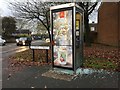
Fenton: vandalised phone box on the corner of Alfred Street
Image: © Jonathan Hutchins
Taken: 12 Nov 2016
0.05 miles
3
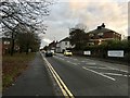
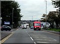
Fenton: Victoria Road
On the right is the Albert House Nursery.
Image: © Jonathan Hutchins
Taken: 12 Nov 2016
0.06 miles
4
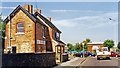
Fenton: near site of former Fenton Manor station, 1995
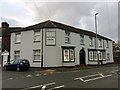
View NE, where Manor Road joins the A50 (Victoria Road). The former North Stafford lines from Stoke-on-Trent to Leek and via Milton junction to Congleton through Biddulph passes underneath and there was a Fenton Manor station below to the left. The passenger service to Biddulph and Congleton ceased from 11/7/27, but the line remained for freight and was not cut back to Biddulph until 1968, mineral traffic on the rest lasted into 1989. The station was closed from 3/5/56 when the Stoke - Leek passenger service was withdrawn, but the track is still in place and the Moorland & City Railway, newly constituted in conjunction with the heritage Churnet Valley Railway, will soon have the service restored.
Image: © Ben Brooksbank
Taken: 4 Aug 1995
0.07 miles
7
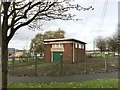
Fenton: electricity substation off Victoria Road
Image: © Jonathan Hutchins
Taken: 12 Nov 2016
0.08 miles
8
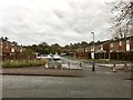
Fenton: Morville Close from Dewsbury Road
Image: © Jonathan Hutchins
Taken: 12 Nov 2016
0.08 miles
9

Fenton Industrial Estate: tenants and map
Image: © Jonathan Hutchins
Taken: 12 Nov 2016
0.08 miles
10
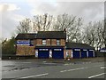
Fenton: Lloyd and Jones
On the corner of Victoria Road and Manor Street, Lloyd and Jones are industrial supplies distributors.
Image: © Jonathan Hutchins
Taken: 12 Nov 2016
0.09 miles