IMAGES TAKEN NEAR TO
Blythe Avenue, STOKE-ON-TRENT, ST3 7JZ
Introduction
This page details the photographs taken nearby to Blythe Avenue, ST3 7JZ by members of the Geograph project.
The Geograph project started in 2005 with the aim of publishing, organising and preserving representative images for every square kilometre of Great Britain, Ireland and the Isle of Man.

There are currently over 7.5m images from over14,400 individuals and you can help contribute to the project by visiting https://www.geograph.org.uk
Image Map
Images are licensed for reuse under creativecommons.org/licenses/by-sa/2.0
Notes
- Clicking on the map will re-center to the selected point.
- The higher the marker number, the further away the image location is from the centre of the postcode.
Image Listing (9 Images Found)
Images are licensed for reuse under creativecommons.org/licenses/by-sa/2.0
Image
Details
Distance
1
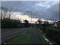
B5029 Grindley Road at Meir Heath
Image: © Jonathan Clitheroe
Taken: 21 Jan 2021
0.13 miles
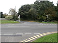
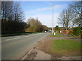
3
The B5029 near its junction with Grange Rd
Image: © John Lord
Taken: 6 Sep 2017
0.17 miles
4
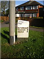
The Meir Heath (East) milepost in its setting
That lamppost is situated immediately in front of the old milepost; how insensitive is that?
Image: © Richard Law
Taken: 7 Apr 2010
0.17 miles
5
The Meir Heath (East) milepost - partial detail
Who in their right mind would plant a lamppost directly in front of the old milepost? Honestly!
Image: © Richard Law
Taken: 7 Apr 2010
0.17 miles
6
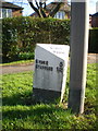
The Meir Heath (East) milepost - partial detail
Who in their right mind would plant a lamppost directly in front of the old milepost? Honestly! It doesn't make for easy photography...
Image: © Richard Law
Taken: 7 Apr 2010
0.17 miles
7
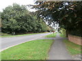
The B5029 near its junction with Grange Rd
Image: © John Lord
Taken: 6 Sep 2017
0.18 miles
8
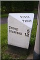
Old Milepost by the B5029, Grindley Lane, Fulford Parish
Cast iron post by the B5029, in parish of FULFORD (STAFFORD District), between Meir Heath and Blythe Bridge, on grass between road and path, on Southeast side of road. Cochrane iron casting, erected by the County Council in the 20th century.
Inscription reads:-
: STONE 5 / STAFFORD 12 : : STONE / PARISH : : BLYTHE BRIDGE 1¼ / FORSBROOK 2 / CHEADLE 5 :
Maker:-
: Cochrane & Co, Dudley. :
Staffordshire HER listed.
HER Number: 51319 https://www.heritagegateway.org.uk/Gateway/Results_Single.aspx?uid=MST12542&resourceID=1010
Milestone Society National ID: ST_SNCD05.
Image: © J Higgins
Taken: 1 Jan 2000
0.21 miles
9
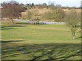
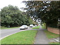
Grindley Park
Houses in the distance are Sandon Road.[Looking NNW]
Image: © John Thorn
Taken: 9 Feb 2006
0.22 miles