
IMAGES TAKEN NEAR TO
Normacot Road, STOKE-ON-TRENT, ST3 1RA
Introduction
This page details the photographs taken nearby to Normacot Road, ST3 1RA by members of the Geograph project.
The Geograph project started in 2005 with the aim of publishing, organising and preserving representative images for every square kilometre of Great Britain, Ireland and the Isle of Man.

There are currently over 7.5m images from over14,400 individuals and you can help contribute to the project by visiting https://www.geograph.org.uk
Image Map
Images are licensed for reuse under creativecommons.org/licenses/by-sa/2.0
Notes
- Clicking on the map will re-center to the selected point.
- The higher the marker number, the further away the image location is from the centre of the postcode.
Image Listing (81 Images Found)
Images are licensed for reuse under creativecommons.org/licenses/by-sa/2.0
Image
Details
Distance
1
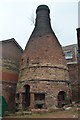
Disused Bottle Kiln
An early photograph Image] shows the kiln is deteriorating condition. The kiln is in a former works complex used by small businesses.
Image: © Ashley Dace
Taken: 2 Mar 2012
0.02 miles
2

Date plaque on St. Mary's Works, Normacot
Central pediment over entrance arch with Palladian window over, and cartouche in the apex, inscribed "St Mary's Mount Pleasant, 1862".
See the works:- http://www.geograph.org.uk/photo/345121
Image: © Steven Birks
Taken: 5 Jan 2006
0.04 miles
3
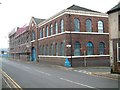
St. Mary's Works, Normacot
On Uttoxeter Road, Normacot, Longton
Buildings forming part of Pottery works. 1862. Brick with terracotta dressings and plain tiled roofs. 2-storeyed, 13 bays (6-1-6). Central pediment over entrance arch with Palladian window over, and cartouche in the apex, inscribed "St Mary's Mount Pleasant, 1862". This entrance bay is flanked by round arched windows recessed in brick architraves with rubbed brick arched heads and keyblocks. Continuous stuccoed sill bands, and stuccoed eaves cornice. Adjoining to the left, a further range added in 1888. 3 storeys, 8 bays (1-6-1) with outer gabled bays with inserted lower windows and tripartite window over, with terracotta panels beneath them, and stone string course.
Image: © Steven Birks
Taken: 5 Jan 2006
0.04 miles
4
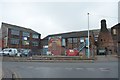
Minkstone Works
Grade-II-listed, late 19th century brick bottle kiln at the former Minkstone Works, on the corner of Warren Street and Normacot Road.
Image: © Ashley Dace
Taken: 2 Mar 2012
0.05 miles
5

Lockett's Lane Footbridge, Uttoxeter Road
Image: © David Dixon
Taken: 8 Aug 2014
0.06 miles
6
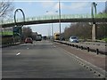
A50 - footbridge close-up
The same footbridge as in http://www.geograph.org.uk/photo/2342480 in close-up.
Image: © Peter Whatley
Taken: 24 Mar 2011
0.06 miles
7
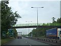
Footbridge over A50 between Lloyd and Warren Streets
The bridge connects the two parts of a former road, now cut short by the A50
Image: © David Smith
Taken: 23 Jul 2013
0.06 miles
8
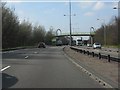
A50 - footbridge west of the Normacot junction
In dualling the A50 between Blythe Bridge and the A500, the builders employed a series of interesting footbridge designs. This is the second, a basic structure enlivened with large diameter "O-rings" which carry lighting above simple supporting pillars. For another example, see: http://www.geograph.org.uk/photo/2342422 .
Image: © Peter Whatley
Taken: 24 Mar 2011
0.06 miles
10
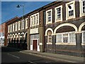
Tams Group - Blyth Works
Tams Group earthenware factory. Known as Blyh Works.
Uttoxeter Road, Normacot, Longton, Stoke-on-Trent
Image: © Steven Birks
Taken: Unknown
0.08 miles