IMAGES TAKEN NEAR TO
Dividy Road, STOKE-ON-TRENT, ST2 9JQ
Introduction
This page details the photographs taken nearby to Dividy Road, ST2 9JQ by members of the Geograph project.
The Geograph project started in 2005 with the aim of publishing, organising and preserving representative images for every square kilometre of Great Britain, Ireland and the Isle of Man.

There are currently over 7.5m images from over14,400 individuals and you can help contribute to the project by visiting https://www.geograph.org.uk
Image Map
Images are licensed for reuse under creativecommons.org/licenses/by-sa/2.0
Notes
- Clicking on the map will re-center to the selected point.
- The higher the marker number, the further away the image location is from the centre of the postcode.
Image Listing (17 Images Found)
Images are licensed for reuse under creativecommons.org/licenses/by-sa/2.0
Image
Details
Distance
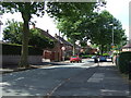
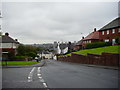
3
Ruxley Road, Bucknall
Looking west along Ruxley Road, and beyond towards Hanley.
Image: © David Weston
Taken: 19 Jun 2017
0.08 miles
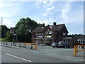
4
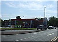
Bucknall China
Chinese restaurant in a former public house on Werrington Road
Image: © JThomas
Taken: 20 Jun 2015
0.12 miles
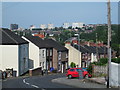
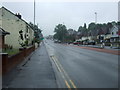
6
Looking west down Ruxley Road, Bucknall
Image: © Eirian Evans
Taken: 26 Sep 2012
0.14 miles
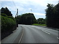
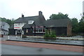
9
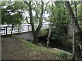
River Trent leaving Bucknall Park
The road bridge has been widened on this side.
Image: © John M
Taken: 20 Sep 2009
0.17 miles
10
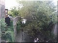
River Trent downstream of Finney Gardens
The river passes behind industrial premises on its course through Stoke-on-Trent.
Image: © John M
Taken: 20 Sep 2009
0.17 miles