
IMAGES TAKEN NEAR TO
Malthouse Road, STOKE-ON-TRENT, ST2 9HY
Introduction
This page details the photographs taken nearby to Malthouse Road, ST2 9HY by members of the Geograph project.
The Geograph project started in 2005 with the aim of publishing, organising and preserving representative images for every square kilometre of Great Britain, Ireland and the Isle of Man.

There are currently over 7.5m images from over14,400 individuals and you can help contribute to the project by visiting https://www.geograph.org.uk
Image Map
Images are licensed for reuse under creativecommons.org/licenses/by-sa/2.0
Notes
- Clicking on the map will re-center to the selected point.
- The higher the marker number, the further away the image location is from the centre of the postcode.
Image Listing (16 Images Found)
Images are licensed for reuse under creativecommons.org/licenses/by-sa/2.0
Image
Details
Distance
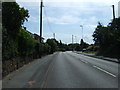
2
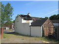
The Red Lion, Bucknall
A derelict pub, seen from the back; Ruxley Road beyond.
Image: © David Weston
Taken: 19 Jun 2017
0.13 miles
3
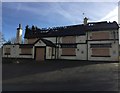
Red Lion, Bucknall (2017)
The Red Lion Hotel located in Bucknall, Stoke-on-Trent, is a pub/inn which has a substantial amount of history. It was closed in January 2017, following a sale to new buyers, and the building has since been subject to arson attacks. The pub opened in the 17th century and is said to have once provided accommodation to the infamous highwayman Dick Turpin. The building/land has previously been used as a court house, prison, hotel and pub/inn. It has previously been reported as a listed building, but is now derelict.
Image: © Samuel Bateman
Taken: 6 Nov 2017
0.13 miles
4
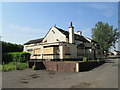
The Red Lion, Bucknall
A derelict pub on Ruxley Road.
Image: © David Weston
Taken: 19 Jun 2017
0.13 miles
5
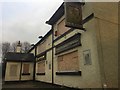
Red Lion, Bucknall (2017)
The Red Lion Hotel located in Bucknall, Stoke-on-Trent, is a pub/inn which has a substantial amount of history. It was closed in January 2017, following a sale to new buyers, and the building has since been subject to arson attacks. The pub opened in the 17th century and is said to have once provided accommodation to the infamous highwayman Dick Turpin. The building/land has previously been used as a court house, prison, hotel and pub/inn. It has previously been reported as a listed building, but is now derelict.
Image: © Samuel Bateman
Taken: 1 Dec 2017
0.13 miles
6
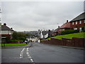
Looking west down Ruxley Road, Bucknall
Image: © Eirian Evans
Taken: 26 Sep 2012
0.15 miles
8
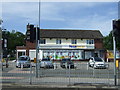
Hillberry Supermarket
Store on Dividy Road.
Image: © JThomas
Taken: 12 Jul 2014
0.20 miles
9
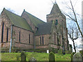
St Mary's church, Bucknall
The church was built in 1718 and became a parish church in 1807.
Image: © Phil Eptlett
Taken: 25 Jan 2006
0.20 miles
10
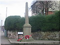
Bucknall War Memorial
A small memorial to the men of the parish who died during World War One. Situated by the side of the A52 road on the outskirts of Stoke on Trent.
Image: © Phil Eptlett
Taken: 25 Jan 2006
0.20 miles