
IMAGES TAKEN NEAR TO
Church View, STAFFORD, ST21 6SU
Introduction
This page details the photographs taken nearby to Church View, ST21 6SU by members of the Geograph project.
The Geograph project started in 2005 with the aim of publishing, organising and preserving representative images for every square kilometre of Great Britain, Ireland and the Isle of Man.

There are currently over 7.5m images from over14,400 individuals and you can help contribute to the project by visiting https://www.geograph.org.uk
Image Map
Images are licensed for reuse under creativecommons.org/licenses/by-sa/2.0
Notes
- Clicking on the map will re-center to the selected point.
- The higher the marker number, the further away the image location is from the centre of the postcode.
Image Listing (19 Images Found)
Images are licensed for reuse under creativecommons.org/licenses/by-sa/2.0
Image
Details
Distance
1
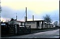
Nelson Hall (1979)
Teachers' Training College.
Image: © Stanley Howe
Taken: Unknown
0.07 miles
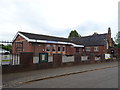
3
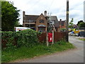
Elizabeth II postbox on the A519, Cotes Heath
Postbox No. ST21 103.
See Image] for close up.
Image: © JThomas
Taken: 1 Jun 2019
0.08 miles
4
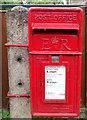
Close up, Elizabeth II postbox on the A519, Cotes Heath
Postbox No. ST21 103.
See Image] for wider view.
Image: © JThomas
Taken: 1 Jun 2019
0.08 miles
5
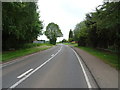
Newcastle Road (A159)
Looking south at Cotes Heath.
Image: © JThomas
Taken: 1 Jun 2019
0.08 miles
7
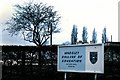
Last throw of the dice!
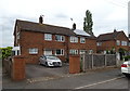
Nelson Hall was an American Army base during the war; the County of Stafford Ladies Teacher Training College afterwards, and then absorbed by Madeley PE College as an annex. This photo of 1979 confirms that status. However Madeley itself closed in 2000, and now it appears to have built over as a housing estate (accessed via Nelson Crescent) near Cotes Heath.
See http://www.madeleyvillage.co.uk/college_history.htm
Image: © Stanley Howe
Taken: Unknown
0.09 miles
8
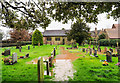
Flooded graveyard at St James Church
St James Church at Cotes Heath is beside the A519; the road is beyond the hedge at the left of the image. That road at the time had a more spectacular area of water across its surface made all the more so as vehicles ploughed through; some lorry drivers seemed to take particular pleasure in creating enormous waves!
Image: © Trevor Littlewood
Taken: 24 Feb 2020
0.10 miles
9
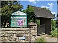
St James Cotes Heath - Entrance
Entrance to the churchyard.
Image: © Andrew Woodvine
Taken: 23 Jun 2022
0.10 miles
10
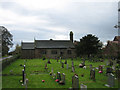
Cotes Heath
St James Church and Churchyard at Cotes Heath
Image: © Anne Pollitt
Taken: 8 Nov 2006
0.10 miles