
IMAGES TAKEN NEAR TO
Green Lane, STAFFORD, ST21 6GH
Introduction
This page details the photographs taken nearby to Green Lane, ST21 6GH by members of the Geograph project.
The Geograph project started in 2005 with the aim of publishing, organising and preserving representative images for every square kilometre of Great Britain, Ireland and the Isle of Man.

There are currently over 7.5m images from over14,400 individuals and you can help contribute to the project by visiting https://www.geograph.org.uk
Image Map
Images are licensed for reuse under creativecommons.org/licenses/by-sa/2.0
Notes
- Clicking on the map will re-center to the selected point.
- The higher the marker number, the further away the image location is from the centre of the postcode.
Image Listing (21 Images Found)
Images are licensed for reuse under creativecommons.org/licenses/by-sa/2.0
Image
Details
Distance
2
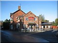
The Badger, Eccleshall
The Badger, formerly known as The Railway Inn, was built when it was anticipated that the railway line would pass north of Eccleshall. Instead Eccleshall was avoided and the railway was routed through Norton Bridge.
Image: © Anne Pollitt
Taken: 4 Nov 2006
0.13 miles
3

The Fire Station's window display
As promised in Image, a view of the old fire-fighting kit on display at the station.
Image: © Richard Law
Taken: 16 Apr 2010
0.16 miles
4
Eccleshall Fire Station
Just inside the plate glass window they display an old, horse drawn fire tender, and a mannequin dressed in the uniform of yesteryear. Unfortunately there was no way of photographing these when I passed, as the strong evening sunlight was causing a reflection of the houses opposite in the glass window. It'll have to wait until another time.
Image: © Richard Law
Taken: 15 Jul 2009
0.18 miles
5
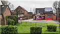
Fire station at Eccleshall
Eccleshall's fire station on the west side of Newport Road, the A519. The 'public space' or garden over which it's viewed has trimmed bushes, perhaps of laurel.
Image: © Trevor Littlewood
Taken: 28 Dec 2021
0.19 miles
6
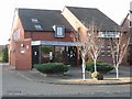
The Fire Station, Eccleshall
Fire Station on the Newport Road
Image: © Anne Pollitt
Taken: 29 Oct 2006
0.19 miles
9
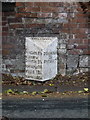
Eccleshall milepost
On the SW side of the A5013 Stafford road, within a few yards of the junction with the A519.
Image: © Richard Law
Taken: 5 Jul 2011
0.23 miles
10
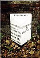
Old Milepost by the A5013, Stafford Road, Eccleshall
Cast iron post by the A5013, in parish of Eccleshall (Stafford District), Stafford Street, South East of A519 roundabout, on the verge in front of brick wall, on South West side of road. Lathe iron casting, erected by the County Council in the 19th/20th century.
Inscription reads:-
: PIPEGATE 11½ / MARKET - / DRAYTON 11½ / NEWCASTLE 11¾ / WOORE 12½ / NANTWICH 20½ : : ECCLESHALL / PARISH : : GT BRIDGEFORD / 3½ / STAFFORD 7 :
Maker:-
: Chas. Lathe, Tipton. :
Milestone Society National ID: ST_STNW07
Image: © J Higgins
Taken: 1 Jan 2000
0.23 miles