
IMAGES TAKEN NEAR TO
Newcastle Road, STAFFORD, ST21 6GA
Introduction
This page details the photographs taken nearby to Newcastle Road, ST21 6GA by members of the Geograph project.
The Geograph project started in 2005 with the aim of publishing, organising and preserving representative images for every square kilometre of Great Britain, Ireland and the Isle of Man.

There are currently over 7.5m images from over14,400 individuals and you can help contribute to the project by visiting https://www.geograph.org.uk
Image Map
Images are licensed for reuse under creativecommons.org/licenses/by-sa/2.0
Notes
- Clicking on the map will re-center to the selected point.
- The higher the marker number, the further away the image location is from the centre of the postcode.
Image Listing (10 Images Found)
Images are licensed for reuse under creativecommons.org/licenses/by-sa/2.0
Image
Details
Distance
1
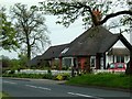
Byanna Lodge
Paradise in the country, just outside of Eccleshall.
Image: © Andy and Hilary
Taken: 23 Apr 2005
0.05 miles
2
North from Eccleshall
The road heading north from Eccleshall.
Image: © Peter Mackenzie
Taken: 25 Apr 2018
0.08 miles
3
A519/ Sturbridge Lane junction near Eccleshall
Image: © Colin Pyle
Taken: 10 Jul 2010
0.10 miles

5

Footpath and track to Pool House off the A519
Image: © Mick Malpass
Taken: 1 Dec 2011
0.12 miles
6
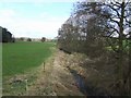
River Sow upstream near Eccleshall
Overflow channel next to the bridge.
Image: © John M
Taken: 28 Mar 2010
0.14 miles
7
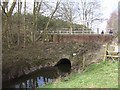
River Sow bridge near Eccleshall
Corrugated steel culvert for the river under the B5026. These are a relatively cheap form of construction provided sufficient cover is available to distribute the wheel loading.
Image: © John M
Taken: 28 Mar 2010
0.15 miles
9

The Eccleshall milestone
Northwards - Beech 6 miles, Clayton 9.25 miles, Newcastle 11 miles.
Southwards - Eccleshall 0.75 miles, Stafford 7.75 miles.
Image: © Richard Law
Taken: 21 Jan 2009
0.21 miles
10

Old Milepost by the A519, Eccleshall parish
Cast iron post by the A519, in parish of ECCLESHALL (STAFFORD District), between Cat's Hill Cross and Eccleshall, in hedge, on West side of road. Lathe iron casting, erected by the County Council in the 19th/20th century.
Inscription reads:-
: BEECH 6 / CLAYTON 9¼ / NEWCASTLE 11 : : ECCLESHALL : : ECCLESHALL / ¾ / STAFFORD 7¾ :
Maker:-
: Chas. Lathe, Tipton. :
Staffordshire HER listed.
HER Number: 51312 https://www.heritagegateway.org.uk/Gateway/Results_Single.aspx?uid=MST12533&resourceID=1010
Milestone Society National ID: ST_NCEH11.
Image: © J Higgins
Taken: 1 Jan 2000
0.21 miles