IMAGES TAKEN NEAR TO
Shebdon, STAFFORD, ST20 0PT
Introduction
This page details the photographs taken nearby to ST20 0PT by members of the Geograph project.
The Geograph project started in 2005 with the aim of publishing, organising and preserving representative images for every square kilometre of Great Britain, Ireland and the Isle of Man.

There are currently over 7.5m images from over14,400 individuals and you can help contribute to the project by visiting https://www.geograph.org.uk
Image Map
Images are licensed for reuse under creativecommons.org/licenses/by-sa/2.0
Notes
- Clicking on the map will re-center to the selected point.
- The higher the marker number, the further away the image location is from the centre of the postcode.
Image Listing (34 Images Found)
Images are licensed for reuse under creativecommons.org/licenses/by-sa/2.0
Image
Details
Distance
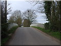
2
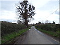
Minor road, Shebdon
Towards Shebdon Bridge.
Image: © JThomas
Taken: 14 Mar 2020
0.07 miles
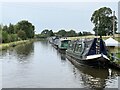
4
The Shropshire Union Canal at Shebdon
Very interesting.
Image: © JThomas
Taken: 14 Mar 2020
0.08 miles
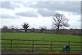
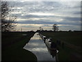
5
Shropshire Union Canal
Near Shebdon Farm.
Image: © Andrew Abbott
Taken: 11 Sep 2022
0.09 miles
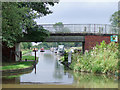
6
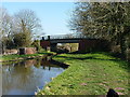
Shebdon Bridge, no 44
Viewed from the towpath to the west, with the canal beyond heading to High Offley and Grub Street.
Image: © Richard Law
Taken: 9 Mar 2014
0.09 miles
7
Bridge over the Shropshire Union Canal, Shebdon
Image: © John Lord
Taken: 11 Apr 2010
0.09 miles
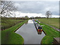
8
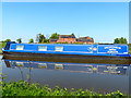
Narrowboat moored along the Shropshire Union Canal
Near Shebdon Farm.
Image: © Mat Fascione
Taken: 6 May 2018
0.09 miles
9
Shebdon Bridge south-east of Knighton, Staffordshire
Shebdon Bridge (No 44) carries the lane from Tunstall. Private long-term moorings on the right are by Shebdon Farm. Past the bridge, the Shropshire Union Canal continues towards another embankment. About five hundred metres ahead on the left is The Wharf Inn* at the base of the embankment. The sign on the bridge advertises it. The current Google satellite hybrid image incorrectly labels Batchacre Park Cottage (no road access) as The Wharf Inn.
*update: closed 2013.
Image: © Roger D Kidd
Taken: 24 Aug 2011
0.09 miles
10
Narrowboats moored for the night, Shebdon
Image: © John Lord
Taken: 11 Apr 2010
0.10 miles