IMAGES TAKEN NEAR TO
Micklegate, STAFFORD, ST19 9JF
Introduction
This page details the photographs taken nearby to Micklegate, ST19 9JF by members of the Geograph project.
The Geograph project started in 2005 with the aim of publishing, organising and preserving representative images for every square kilometre of Great Britain, Ireland and the Isle of Man.

There are currently over 7.5m images from over14,400 individuals and you can help contribute to the project by visiting https://www.geograph.org.uk
Image Map
Images are licensed for reuse under creativecommons.org/licenses/by-sa/2.0
Notes
- Clicking on the map will re-center to the selected point.
- The higher the marker number, the further away the image location is from the centre of the postcode.
Image Listing (7 Images Found)
Images are licensed for reuse under creativecommons.org/licenses/by-sa/2.0
Image
Details
Distance
1
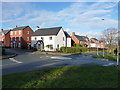
New housing to the north of Brewood
The maps don't yet show this development, which is beside Engleton Lane leading up to the A5.
Image: © Richard Law
Taken: 17 Jan 2015
0.12 miles
3
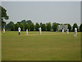
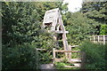
Brewood Cricket Club
The cricket pitch on the outskirts of Brewood
Image: © A Holmes
Taken: 20 Jun 2006
0.17 miles
4
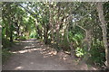
Footpath through Barnfield Sandbeds
Quarrying finished 40 years ago and the tip has reverted to nature. It was opened as a nature reserve in 2010. The ground drops steeply away to the right of the footpath.
Image: © John M
Taken: 4 Sep 2013
0.18 miles
5
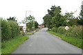
Entering Brewood from Somerford Bridge
Image: © Mick Malpass
Taken: 30 Jun 2011
0.20 miles